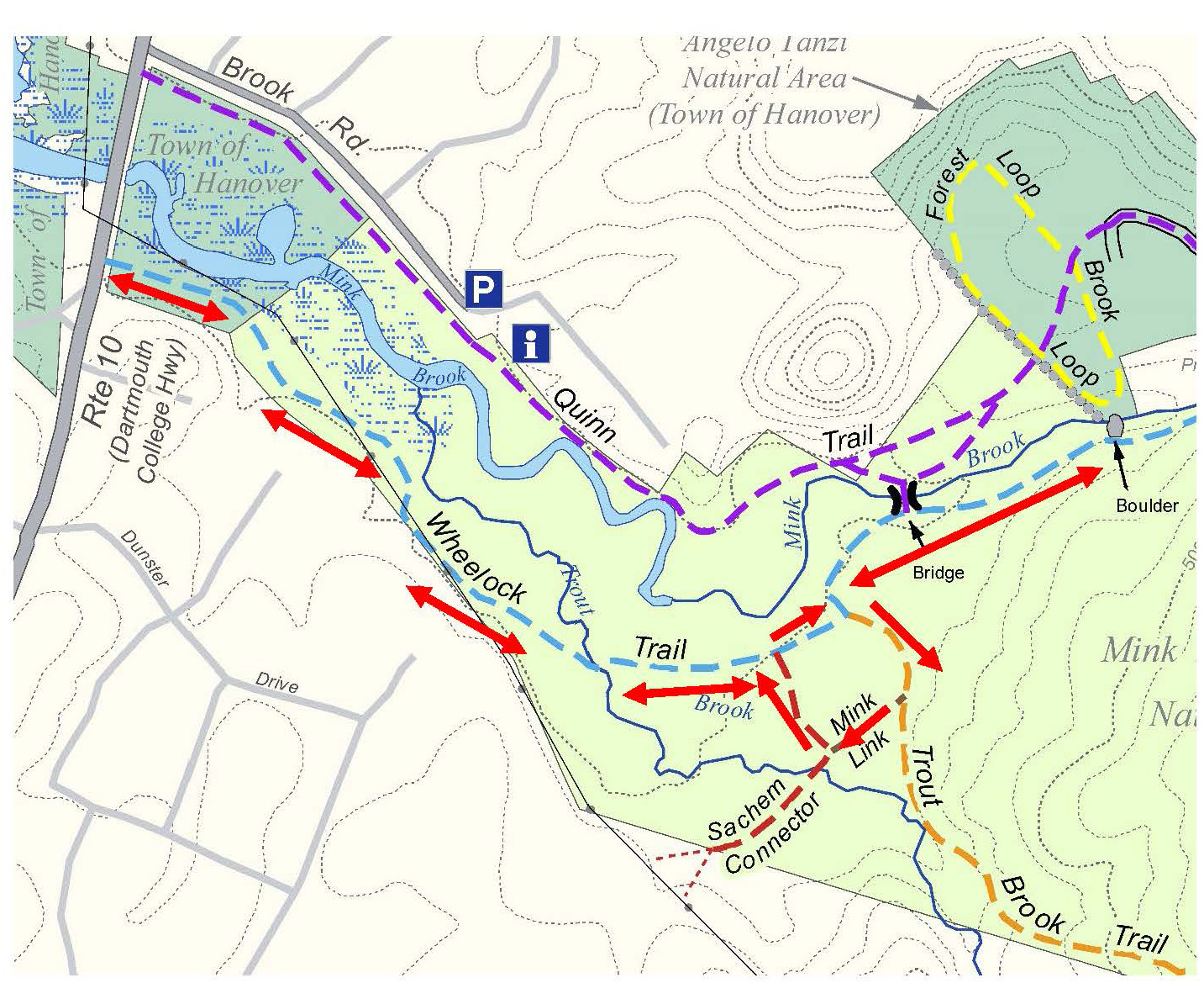
Driving directions:
- From Etna Village, take Ruddsboro Rd for 1.5 miles to Three Mile Rd.
- Turn left and proceed for 1.8 miles. Turn right onto the Wolfeboro Rd and park on right before red gate.
- Please park courteously and do not block gate or private drives. Try not to run over clumps of red trillium!
What you should know:
- Leave no trace — please carry out your own trash
- Trails are open for foot travel at all seasons
- Please pick up after your pet; dogs must be under the direct control of their owners
- No camping or fires
- Hunting is permitted in season
- Leave wildflowers, fungi, and wildlife undisturbed
- The 140-acre Headwaters Forest on Moose Mountain is owned and managed by the Hanover Conservancy.
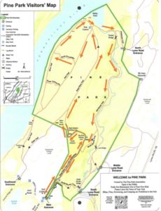
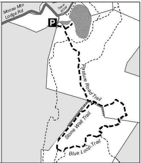
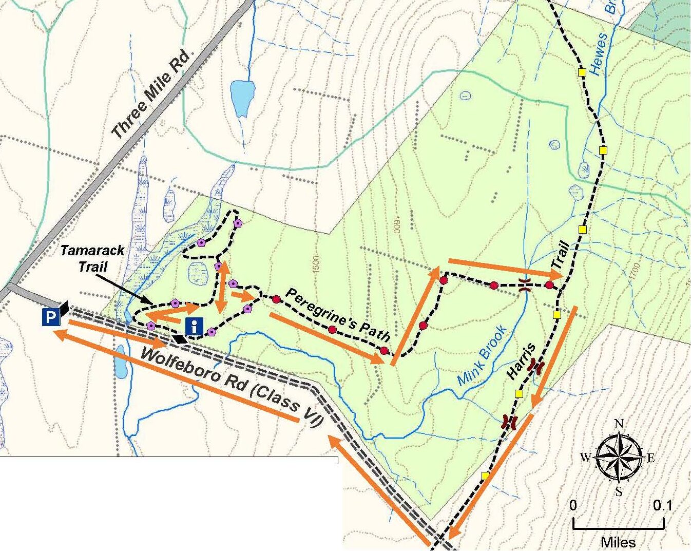
Headwaters Forest Spring Loop – Full PDF
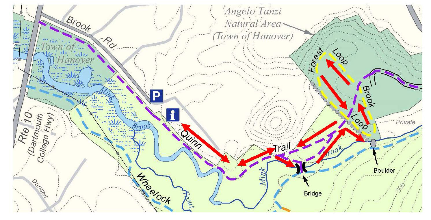
BRIEF HIKING DIRECTIONS
- Begin at the red gate and walk east on the Wolfeboro Road to a gray metal gate at left
- Visit the kiosk before taking the Tamarack Trail left to the frog pond
- Skirt the wooded wetland to a far corner of the meadow marked by birches
- Turn left and follow a boardwalk to a secluded meadow
- Retrace your steps to the main meadow and walk uphill to the opening in the woods marked Peregrine’s Path
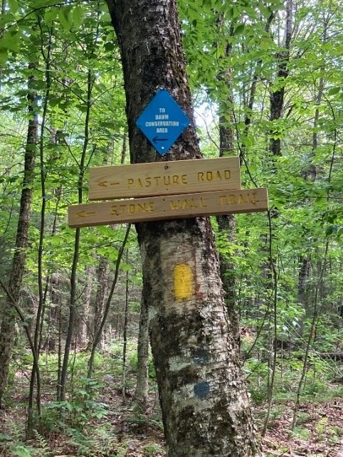
- Follow Peregrine’s Path up through the forest to a stone wall-lined sheep lane
- Turn right, following the lane, cross Mink Brook on a small footbridge, and continue to the Harris Trail
- Turn right onto the Harris Trail and follow it to the Wolfeboro Road
- Turn right onto the Wolfeboro Road and walk down the slope to return to your car
FULL DIRECTIONS
- Begin your hike at the red gate marking the historic Wolfeboro Road’s change from Class V to Class VI.
- A few minutes’ walk brings you to a grey metal gate across a gap in the road-side stone wall at left. Walk around the gate to visit the trailhead kiosk. You’ll find a map and trail guide in the dispenser along with a
grateful acknowledgment of all those friends, families, and organizations who helped the Hanover Conservancy purchase and protect this land in 2023. - Take a moment to inspect the antique cultivator parked beneath the kiosk. It speaks volumes about the hard work involved in farming this land in years past. Not long after the Wolfeboro Road was cut over Moose
Mountain to Three Mile Road in 1772, a farm family set up at the junction and began clearing the slope behind you, first for a subsistence farm. Later came sheep, then cattle. The last to farm this land was Dick
Kendall and his family, from whom the Conservancy purchased his 150 acres.
- Turn left on the Tamarack Trail to visit the little frog pond at the base of the slope. Look for egg masses and hope for a visit from the handsome pair of mallards who greeted us the day we visited. Beyond, the red farmhouse rests on the site of the original late 18th century cape, rebuilt by Dick Kendall 60 years ago.
- Facing the pond, note the tall stand of tamaracks gathered around a single pine off to your right, and make a point of visiting again in late fall to catch them in their golden
glory. In early May, bundles of bright green needles are just erupting from the trees’ glowing russet twigs. Tamaracks, also known as larch or hackmatack, are our only
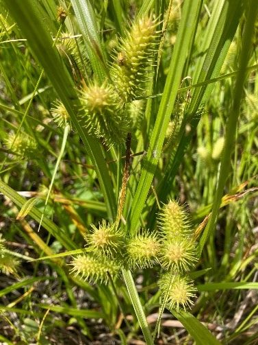
native deciduous conifer. - Head toward them, following the curve of the wetland edge. At this season, a variety of willows showing off their yellow twigs and others with fluffy green foxtail-shaped
inflorescences dominate the scene. Willows love wet feet, as do speckled alders, whose unlikely-looking fat cones top each branch. (If you don’t appreciate wet feet,
admire these wetland dwellers from a distance). Shrubby wetlands like this offer great cover for a variety of wildlife while storing water from heavy storms to release it slowly downstream – in this case, to Mink Brook.
- Follow the wetland edge to the right and gradually uphill through the moist meadow. At this season, “camo”
colored trout lily leaves underfoot seem out of place but are curiously thriving. In high summer, this is a great
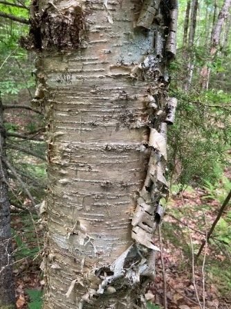
place for lowbush blueberries. - Climb the far side of the meadow opposite the kiosk to a gathering of graceful white-barked birches and popples. Turning left around this corner reveals a wooded passageway marked by a bog bridge. Here, the antique cultivator rested for years – keeping a 1960s VW bus company (now reincarnated elsewhere). At right, a yellow sign indicates the continuation of the Tamarack Trail. Follow the boardwalk north, thanking a grant from Mascoma Savings Bank for the lumber keeping your feet dry.
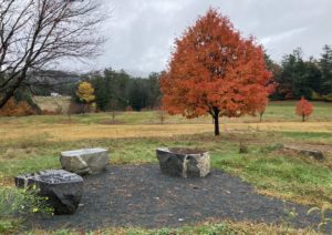
- The boardwalk invites you to visit a beautiful secluded meadow. Near the middle is a pile of stones, left by a long-ago farmer who had picked the rock out of his fields and moved them here on a stoneboat (a low wooden sled) with the help of his horse, but never got around to using them in a stone wall.
- Years ago, the wooded wetland before you was an open beaver pond where the Kendall children learned to skate. The beavers eventually ate themselves out of house and home, and moved on. In their absence, birch and popple returned.
- Return via the boardwalk to the larger meadow and turn left up the hill. As you approach an opening in the woods ahead, pass a cluster of old apple trees on your left. Every farm once had an orchard, not only for fruit to eat and cook, but also for apple cider vinegar, a useful preservative.

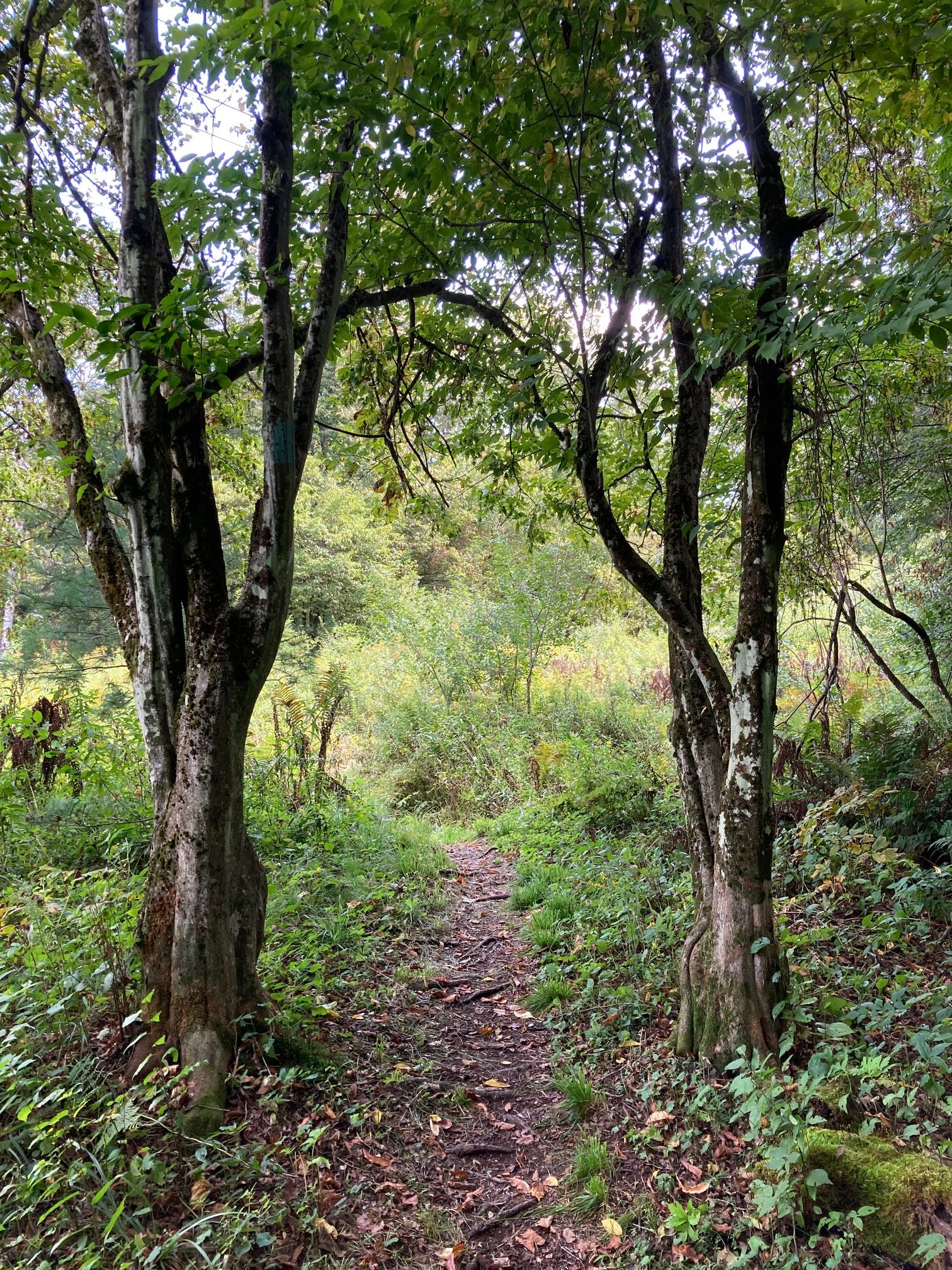
- Find the entrance to Peregrine’s Path, which follows an old woods road into the forest. The family of
Peregrine Spiegel, who often hiked and skied this path, was instrumental in helping the Conservancy protect
this land after the passing of its owner. The path is marked with cranberry blazes. - Soon after leaving the meadow, note a group of honeysuckle bushes at left, marked with orange tape. This property has suffered only slightly from invasive plants such as these, but it’s not surprising to find them along what was a log-hauling road. They are on the list to be removed so they cannot spread further.
- Pass through a log landing and an area of close-growing small trees. This new forest was the last area where Kendall cut firewood to heat his home, and it is now growing back. Beyond, white birch represents a slightly later stage of this early successional forest.
- Continue on as the old woods road climbs gently up and bears left on the last bit of uphill walking today.
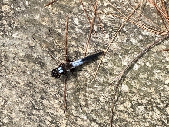
- Just after this turn, be on the lookout for handsome patches of our three most common clubmosses, beginning with ground pine on the left, followed on the right by the well-named erect shining clubmoss and then ground cedar with its flattened, scale-like leaves. These ancient plants spread along the forest floor by creeping rhizomes.
- About 10 minutes after leaving the meadow, you arrive at a surprising sight – a bob house in the middle of the woods! What is an ice-fishing shack doing here? After
spending time on Post Pond and other more conventional places, it took up duty as a place for Dick Kendall to store his chainsaw and get out of the rain. The Conservancy
is hoping to retrofit it for a new role. The opening visible at right is the former site of Dick Kendall’s portable sawmill operation. Here’s a good glimpse of the Moose
Mountain ridge above.
- Continue on Peregrine’s Path, passing left of the bob house on the straight, flat trail. In a few minutes you’ll arrive at a large red maple, double-blazed to indicate a turn at a stone wall. A flat stone at its base invites you to sit for a drink and snack. Healthy outdoor recreation in a natural place like this is one reason why the Moose Plate program made a grant to the Hanover Conservancy to
help protect this land. - While you’re there, gaze up amid the bare branches to admire the maple’s lesser known showy season – its tiny yet brilliant red flowers, which can make quite a splash
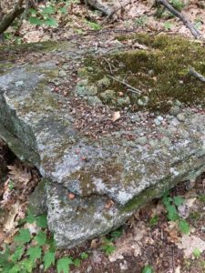
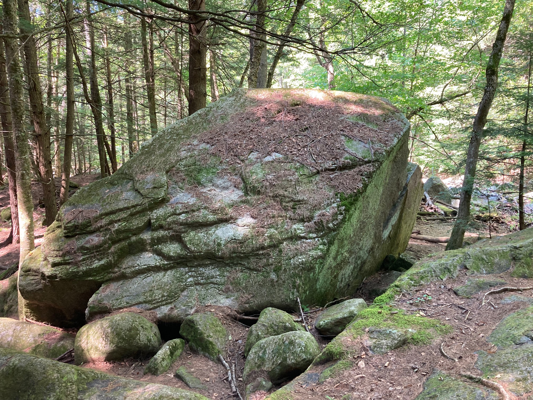
against a bluebird sky. Sugar maples have yellowish-green flowers. Both are wind pollinated and typically have separate male and female flowers on different branches. - After admiring the flower show overhead, look down at your feet for an eye-catching boulder of quartzite. Moose Mountain features many quartzite intrusions. The milky white
stone gleams on the sunny forest floor in early spring before foliage emerges to shade it. The tiny single green lily-like leaves at your feet are Canada mayflower. - Before continuing, look back at the crowded young forest you’re leaving behind as you turn right onto the old sheep lane and into an older forest where competition has thinned out the trees over time. From the 1820s until the Civil War, the Sheep Craze took hold in the Upper Valley, and Moose Mountain’s slopes were cleared up to about the 1700’ elevation to provide pasture for them. In 1840, over 11,000 sheep grazed in Hanover. As the wool textile industry moved south, farmers abandoned their most distant pastures and the forest returned, with older forests on pastures abandoned the longest. We see the signature of that here.
- Follow the stone wall down the sheep lane, alert for a few remaining stubs of young trees that had been cleared from the path. In six minutes, reach a tiny valley where the wall ends at a large angular boulder with an embedded intrusion of white stone. What sort of animal does it remind you of?
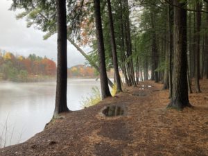
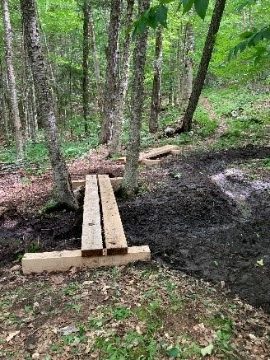
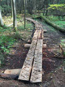
- Arrive at a new footbridge, built by the Conservancy in 2024 with the help of the Upper Valley Trails Alliance High School Trail Crew to protect nascent Mink Brook. The tiny stream’s waters are clear and cold, a sign they are well protected by the undisturbed forest and will provide good rearing habitat for young brook trout downstream. This is one reason the Greater Upper Valley Chapter of Trout Unlimited provided a grant to help build this bridge. Young red spruce, important for ruffed grouse, cluster nearby.
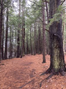
- Cross the bridge and follow the new red-blazed, winding path back out of the little valley past stands of trout lilies into a mature, open forest of glistening yellow birch, maples, ash, and beech.
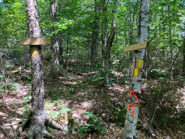
- A few minutes’ walk from the bridge, arrive at the Harris Trail, which runs north-south along the contour, halfway up the mountain ridge. The original route of the Appalachian Trail, built in the 1920s, the Harris Trail is a favorite with backcountry skiers and hikers. It runs from Moose Mountain Lodge Road north to Goose Pond Road. The longest single section is across the Headwaters Forest.
- Note the trio of gray-barked beech trees on the far side of the Harris Trail. Two, including the one marked with pink flagging, display the pitted and scarred bark of trees suffering from beech bark disease. The largest, however, has completely smooth, healthy bark and appears to be genetically resistant to the disfiguring disease. Moreover, its sturdy stem exhibits curious wrinkles that resemble an elephant’s leg. We’ve consulted many experts, and the only explanation offered is that the tree must have responded to strong winds at one time.

- Turn right on the blue-blazed Harris Trail and head south through a gap in a stone wall. At this season, before the understory leafs out, you can see far up the hillside on your left to a line of ledges that could offer good bobcat denning. Bobcats share the forest with other wide-ranging wildlife like moose, deer, black bear, coyote, and other smaller mammals. Connecting this forest with the protected Appalachian Trail corridor and the Conservancy’s own Mayor-Niles and Britton Forests is one reason why the Land and Community Heritage Investment program made a major grant to the Hanover Conservancy to help protect this land.
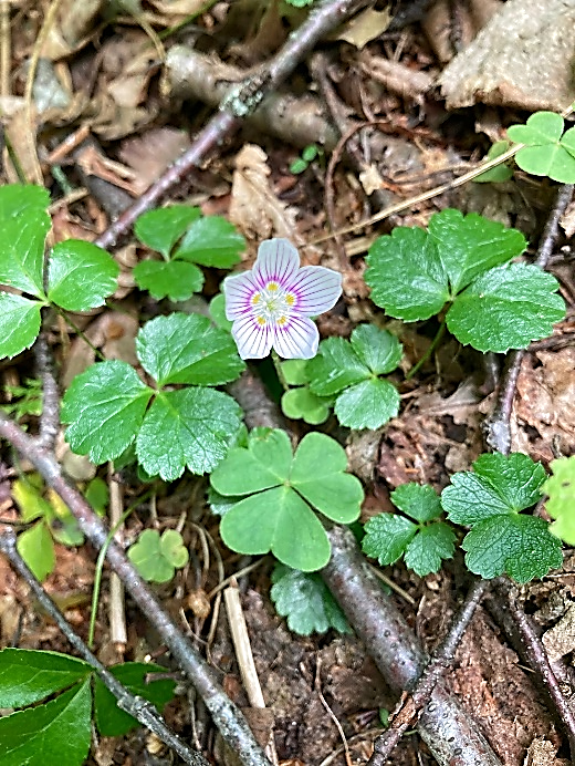
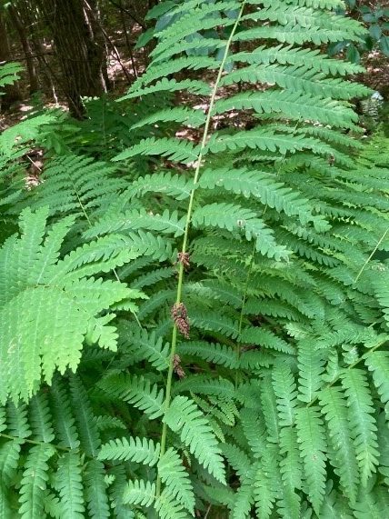
- As you walk this wide, flat trail, keep an eye out for the evergreen Christmas fern along with ephemeral spring wildflowers such as red trillium, wild oats, and tiny
roundleaf yellow violets.
- Five minutes’ walk from the elephant beech, you’ll encounter a second, larger footbridge, also built by the high school trail crew, to keep hikers from tramping through Mink Brook’s headwaters and seeps. The muddy area that once surrounded this site is now beginning to heal, and the water flows clear. One end is tapered to help skiers cross without catching a tip.
- These tiny seeps and streams play a key part in climate change resilience for downstream communities like Etna Village. Far up here in Mink Brook’s headwaters, the forest and undisturbed duff layer on the floor not only lock up carbon in leaves, wood, and soil, they also hold back stormwater like a sponge, keeping flooding under control and streamflow steadier throughout the year. This is one reason why the Upper Connecticut River Mitigation and Enhancement Fund made a major grant to the Hanover Conservancy to help protect this land.
- Four minutes later, cross a third new bridge. Not only do these dry crossings protect the water, they keep skiers out of icy conditions in winter. Look for the lush bright green accordion-leaved foliage of false hellebore nearby. This exuberant member of the lily family appreciates wet woods like this.

- Continue south on the Harris Trail through a forest showing a healthy range of tree species and ages. Some of the oaks and maples are truly impressive. Such diversity makes this forest more resilient to severe storms, insect attacks, and other stressors. This is one reason why The Nature Conservancy’s Resilient and Connected Appalachians grant program made a grant to the Hanover Conservancy to help protect this land.
- On the right you’ll soon begin to notice small green HC boundary markers indicating the Harris Trail has crossed onto the neighboring private lot. Orange tape warns of remnants of barbed wire along the boundary.
- Six minutes’ walk from the last bridge, cross over a short wooden structure to deliver you dry-footed to the old Wolfeboro Road. It’s a complex junction out here in the woods! Uphill to your left, the historic road bears
right and up the mountainside to cross the Appalachian Trail before plunging down to the valley of Tunis Brook and Goose Pond. Branching to the left is a private drive. Across the road, the Harris Trail continues
south through Dartmouth College land. - Turn right to head down the hill, following the path colonial governor John Wentworth built in 1772 from his home in the Lakes Region so he could attend commencement ceremonies at Dartmouth College. Did he really
think it was a good idea to run a road straight up a mountain and down the other side? The story goes that he enjoyed roughing it so much that he camped out with his survey crew while his wife was busy planning the
new ballroom at the governor’s mansion back in Wolfeboro. The early road does continue on to the college campus, passable mostly by foot and in some cases by car. - As you follow the road gently downhill, another of Mink Brook’s headwater streams follows on the right. Soon, the sound of actively flowing water alerts you that all the streams you crossed earlier have blended and
are now on their way downhill. - Six minutes’ walk past the Harris Trail junction, the Wolfeboro Road bends gently left between a leafy hemlock and a pine. On your right an open area appears, bounded by three strands of barbed wire over the
early stone wall, indicating a former cattle pasture. The former owner referred to this place as “the bean patch” – perhaps he grew beans here at one time, or perhaps he just enjoyed having a quiet place to visit with a view. Because Mink Brook is so close by and should be protected with streamside vegetation, the Conservancy will allow this area to grow up, providing good habitat for grouse and some habitat diversity while fast-growing young trees pack away carbon at a high rate. - Continue down the Wolfeboro Road for a few more minutes to where the road flattens out. Admire the dainty waterfall at right, where tiny Mink Brook leaves the Headwaters Forest and continues under the road on its
way to Etna and the Connecticut River. This is where, in 2012, NH Fish and Game biologists and Trout Unlimited volunteers recorded one of the five best sites for wild brook trout in Mink Brook’s entire 18 square mile
watershed. That’s one reason why the NH Fish and Game Department’s fisheries habitat program made a grant to the Hanover Conservancy to help protect this land.
- Continue on down the Wolfeboro Road for another five minutes to return to your car. Thank you for visiting!
Thanks to The Conservation Fund, the NH Land and Community Heritage Investment Program,
Upper Connecticut River Mitigation and Enhancement Fund,
The Nature Conservancy’s Resilient and Connected Appalachians Program,
New Hampshire Moose Plate Program,
NH Fish and Game Department,
Greater Upper Valley Chapter of Trout Unlimited,
Upper Valley Trails Alliance,
the Kendall family, and the many friends and neighbors
who contributed in so many ways to the protection of the Headwaters Forest.
Learn more about the Headwaters Forest here.