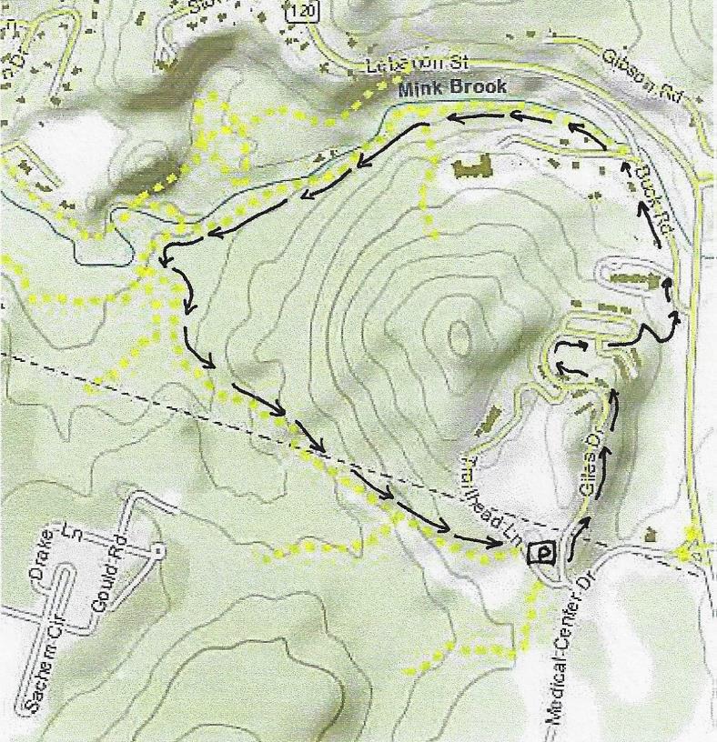
You can drive to the take-off point at Gile Hill OR walk from DHMC on medical center campus trails.
From downtown Hanover, take Lebanon St./Route 120 south to the first light after Greensboro Road, at Medical Center Drive. Turn R at the light, pass the gas station, cross the bridge, and take the first R to Gile Drive.
Turn immediately L into the gravel parking area encircled by large stones, and park. This is your starting point.
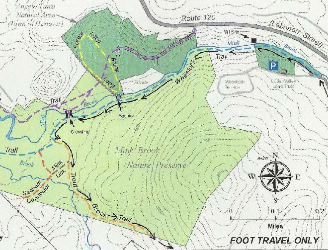
Today’s hike is a loop through the Mink Brook Nature Preserve and adjoining Gile Hill area, encircling the 800’ rocky knob highlighted on the map at R.
What You Should Know
This is a moderately challenging hike, if only because it uses every sort of path you can imagine – from wide and paved to narrow and rocky, flat to steep – and everything in between. Wear sturdy shoes!
You’ll pass through surroundings that vary from a deep hemlock forest to sculpted grassy slopes between apartment buildings. It’s good to know such wild places are so close at hand.
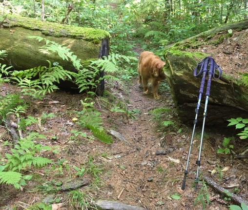
Dogs are welcome but must be leashed while walking through Gile Hill and must always be under your close control. Please pick up after your pet.
Bicycles are not permitted in the Mink Brook Nature Preserve.
Hiking Directions
To begin your hike, walk to the paved road to the Gile Hill development and turn L onto the paved sidewalk just beyond. Follow the sidewalk as it crosses the access road several times and continues down past the apartment buildings. When the sidewalk ends, continue a short distance to White Pine Oval. Take the nearer end of the oval – your destination is a crosswalk at the far end that leads you to a paved path. Along the way, notice a “wall” of stones inside a gabion cage, a stark contrast to the native boulders visible just beyond and the early stone walls you’ll observe later on this trip.
Walk past the wooden rail fence to a crosswalk where you’ll take the wide paved path to Buck Road. Just as it curves L, note a steep sided trench at R, built to capture stormwater runoff from the paved areas and roofs. Before 2006, when the Gile Hill development was built, this entire hillside was a steep, forested jumble of boulders. It presented such an engineering challenge that it was the field site focus of a regional conference on stormwater management techniques.
The paved path ends at Buck Road near Route 120. Turn L and head down the hill on Buck Road, which was once the main road linking Lebanon and Hanover before 120 was built. In a few minutes, Buck Road swings L just before the narrow bridge that once carried it over Mink Brook.
A few paces beyond the turn, look for the Wheelock Trail just before a fire hydrant.
Named for Eleazar Wheelock, founder of Dartmouth College (more about him in a minute), the blue-blazed trail begins as a narrow, rocky path threading among rocks and roots close to Mink Brook. You’re greeted by the sound of the tumbling brook and the cool sweet air of the protective forest, a stark change from Buck Road and Gile Hill. The Upper Valley Land Trust owns this land on the south side of the brook; you’ll pass beneath UVLT’s office perched at the top of the bank. UVLT was instrumental in protecting this parcel and the larger Mink Brook Nature Preserve in 1999, working hand in hand with the Hanover Conservancy (then known as the Hanover Conservation Council).
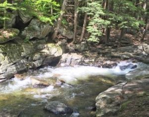
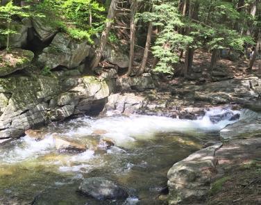
Five minutes from Buck Road, look for a rocky ledge on the far side of the brook where the water spills over a small falls. Amid the foliage above, you can make out the stone wall of an old mill structure. Watch your step among the tangle of roots across the trail. There’s a better view of the falls from below. You’re looking at the reason why Dartmouth College is in Hanover and not somewhere else!
1778 map of SW Hanover showing Mink Brook and college and Wheelock holdingsIn the late 1760s, when Rev. Wheelock was searching for a town to locate his college, colonial governor John Wentworth and the proprietors of newly-founded Hanover and Lebanon joined together to offer him 2,000 acres surrounding this brook. This, the largest stream in Hanover, has an 18 square mile watershed, thus guaranteeing a good flow, and this falls offered a promising spot for a grist mill. This was essential gear for grinding grain to make flour to bake bread to feed hungry young men. The deal was sealed, and in 2019, Dartmouth celebrated its 250th anniversary, all thanks to Mink Brook. (After a first mill failed, Israel Woodward built this mill for Wheelock in 1771-1772).
But we digress. The Wheelock Trail continues into a cool glen shaded by hemlocks and becomes a wider path. Soon it heads up to a break in the canopy and bears R across land owned by Wheelock Terrace. Here, the sewer line passes under your feet on its way to the wastewater treatment plant at the mouth of Mink Brook.
Enter the woods once again at a small sign (TRAIL ->). In a few moments you’ll encounter a low stone wall marking an early boundary; today it announces that you have arrived at the Hanover Conservancy’s Mink Brook Nature Preserve. A remnant of barbed wire clings to a tree at L, and HC’s even more contemporary boundary marker, a 4’ plastic square, hangs on a tree at R. This stone wall marks the ancient property line between the 300 acre Wheelock parcel and the 1000 acre Dartmouth College parcel of land. That easterly property line makes a series of erratic westerly jogs as it runs north over the top of the hill and descends the northerly side. This reflects the fact that in 1771, after Wheelock had established his first mill on Mink Brook, it was found to be located not on Dartmouth property as the College Trustees had intended, but rather on Wheelock’s private property. Therefore, to appease the Trustees, the original property line was adjusted westerly, giving more land to the College.
Continue as the path becomes level and wide among the hemlocks. The brook’s floodplain may be flat, but you’re aware of steep, high slopes both across the brook and to your L. Soon they begin to crowd the path as steep ravines appear at L. What’s going on here? You are actually hiking along what was once the bottom of glacial Lake Hitchcock. This frigid lake covered the Connecticut River valley from Middletown, CT to Littleton, NH after the river’s waters were trapped by a dam of debris dropped by the glacier as it melted. Thousands of years later that dam broke, leaving us with the beautiful winding Connecticut River of today. While the lake was in place, however, soil washing in from the uplands settled on the lake bottom. In still water, such as that quieted by a veneer of ice, the finest particles of clay sink to the bottom. When the lake drained, Mink Brook’s braided waters flowed down through the newly exposed sediments, slicing deep channels through them on their way to meet the river. These old channels are now the steep ravines that surround you.
About 15 minutes’ walk from Buck Road, you reach a beautiful rocky gorge. The trail briefly becomes indistinct on the slope but picks up later. Take a moment to visit the water’s edge and discover a lovely pool behind a low dam. This dam was built in the 1920s to create a swimming hole for a seasonal cottage once owned by the Tanzi family. The cottage is now gone, but a nearby private residence remains on the opposite bank. Continue west on the Wheelock Trail.
Four minutes’ walk past the gorge a flat terrace appears at L; this is part of the old glacial lake bed, formed when the lake had partially dropped.
Two minutes later, you arrive at a dramatic spot where an enormous boulder guards the brook. The footing is tricky here. Climb below the boulder to admire its sheer face, but please resist the temptation to climb it. A look toward the brook may reveal woody debris tossed here by high water. A nearby tree shows the scars of two strands of barbed wire, two and three feet off the ground, presumably set 150 years ago to protect grazing sheep from falling into the water.
Just beyond the huge boulder is a very old stone wall with hemlocks growing from it. Scan the hillside at L to marvel at another partial wall of larger boulders. This land has clearly been used for many, many years.
Five minutes’ walk past the boulder brings you to a recently abandoned stream channel. Before Tropical Storm Irene, Mink Brook ran through this now nearly dry sandy area, but the August 2011 surge tore a new channel slightly north, where it now flows except in times of very high water. The trail heads toward the log crossing built in 2009. Just before the bridge are signs of erosion that began with Irene and continues today – a hemlock hangs out over the water, its roots exposed, and on the far side, the brook is scouring the north bank. Nearby at L, ferns occupy the swale of yet an earlier abandoned channel. This is a pretty busy place!
At the log crossing, you have a choice of exploring trails on the north side of the brook. If you do, please cross the log one at a time. A sign at L indicates that you have come from Buck Road and are headed toward Lebanon. Continue straight on the Wheelock Trail; it soon begins to swing away from the brook.
Just past a dead tree at R, look L for bright pink “whiskers” marking a study plot of Trillium. This study, conducted by the Biodiversity Committee of the Hanover Conservation Commission, is following survival of this native wildflower under heavy deer browse pressure.
A few steps further, a trail comes in at R. Take this for a few yards back to the streambank. Plans for a 32-lot housing development on this land included a road and bridge across the brook at this point. In 1999, to save this land as a refuge for the community – both human and wild – the Hanover Conservancy and Upper Valley Land Trust worked together to purchase the property. Over 500 households contributed, with Dartmouth College providing the major gift that ultimately made it possible to protect this land. Today, the 112-acre preserve is owned and managed by the Hanover Conservancy with help from volunteers. Conservation restrictions held by UVLT guide the preserve’s management.
Return to the Wheelock Trail, trying to visualize this place as a residential subdivision and yourself standing on a paved road leading to driveways, garages, mailboxes, landscaped yards, and houses with dogs and cats.
A few steps bring you to another junction, where the Wheelock Trail turns R and crosses a drainage over stones placed to allow both feet and water to pass. Here, you stay straight and continue on the orange-blazed Trout Brook Trail, a flat and gently winding pine-needle strewn path.
At R, pockets of ferny wetlands adorn the forest floor. It is easy to imagine how useful they are as sponges during heavy rains, holding back stormwater and protecting the brook from flooding and erosion.
Five minutes’ walk from the would-be subdivision bridge, arrive at another junction where a trail at R leads to Sachem Village. A small sign reminds that bicycles are not permitted at the Mink Brook Nature Preserve due to a condition placed on the College’s major gift that protected the land. The trail begins to climb as the mild music of falling water is heard.
Two minutes further, arrive at a small but picturesque waterfall on Trout Brook. At its foot are twin boulders, each wearing a rakish wig of moss and ferns. During a study of wild brook trout habitat by the NH Fish and Game Department and Trout Unlimited in 2012, biologists agreed that the protected forest in this area provides extremely high quality habitat for wild brook trout. (The trout are small, and deserve to live and grow another day.)
Keep the brook company for a short while, but watch for orange blazes as the trail swings L and heads up and away. Through the trees at L above is a flattish area where millet was grown by the Stone family when this land was part of their farm in the 1960s.
The Trout Brook Trail now heads steadily up, with Trout Brook singing away below to the R.
Seven minutes’ walk from the waterfall, you reach the height of land on the trail and emerge, blinking in the sudden change of light, into the clearing for a huge powerline. Needless to say, you’ve found the southern boundary of the nature preserve, which is also the boundary between Hanover and Lebanon.
Take a moment to adjust to the sharp contrast and then continue on the path, which bears L and down toward the power line. Coarse rock and gravel mark the route, which soon plunges up again, sometimes quite steeply, through clover, daisies, briars, coltsfoot, and 5’ white pines. It’s difficult to imagine that this area once looked exactly like what you just hiked. Replacing towering hemlocks with towering metal poles makes a big difference to everything beneath them!
About 10 minutes from the woodland’s edge, you arrive at another height of land affording a view of an electric transformer station below at R. Continue on the path, heading slightly L toward a gap in the trees and a yellow gate. Just beyond the gate is Trailhead Lane; turn R to reach the parking area where you left your car. If you walked from DHMC, turn R again at Medical Center Drive.
Looking for something to do on this beautiful long weekend? Check out one of our Hikes of the Month, which include detailed directions and history on each location.
When you’re out there, take a moment to appreciate the incredible array of natural resources in the Upper Valley! These pristine streams and rich soils were cared for by indigenous peoples, enabled farming and forestry to thrive, and now support recreation, tourism and much, much more.
Send us your foliage photos from around the UV and help inspire others to get outdoors & explore!
From the traffic light at Route 120 and Greensboro Road, take Greensboro Road east for 1.8 miles to its junction with Etna and Great Hollow Roads.
Park at the roadside pull-off. If you prefer off-road parking, turn in at David Farr Memorial Park and bear R and downhill to a shaded gravel parking area.
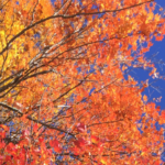
Today’s hike on an historic highway includes a loop through the now-protected Hudson Farm’s fields and forest.
What You Should Know
This is a fun and easy hike with a few sections of tricky footing among roots or rocks. The route is well-blazed.
The route follows an early road and then travels a loop on one of Hanover’s newest conservation lands. In 2017, the National Park Service purchased the Hudson Farm (brown-shaded area on map) to permanently protect it as part of the Appalachian Trail corridor.
Trails are maintained by Hanover Trails Committee volunteers and Berrill Farm neighbors.
Dogs are welcome but must be under your control; please pick up after your pet.
Snowmobiles, ATVs, and bicycles are not permitted.
Hiking Directions
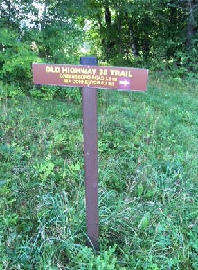
Begin your hike on Greensboro Road at the blue town sign marking the Old Highway 38 Trail, directly opposite the town’s Farr Memorial Park.
The old road leads between two contemporary houses and shortly turns R (marked with arrow), immediately diving back into time at a pair of old stone walls – the first of many you will encounter today.
Don’t be dismayed by the steep path that suddenly appears– the rest of the hike is gentle and rolling. Follow the yellow blazes into the woods.
Town Highway 38 has a murky history. Laid out in 1795, it connected Greensboro and Trescott Roads. It was later discontinued, but its exact route was so hard to trace that when planning began for Berrill Farms in 1979, the town agreed with the developer on a route to be called the “Old Highway 38 Trail.”
The trail passes through a knobby landscape covered with ferns and a young forest of white pine. The stubs of lower branches encircling each tree are clues that these pines grew up together in an abandoned field, self-pruning those branches as the canopy closed in and blocked out the sun. A few venerable, much older maples survive.
Eight minutes from the trailhead you cross a fine stone wall. Follow it with your eyes to another at R, running parallel to the trail.
A few minutes later, take care crossing a wet spot, where “tree cookies” placed as pavers can be slippery. A small wooden bridge takes the trail over a space that is wetter in other seasons.
Six minutes from the first wall crossing, a trail comes in at L at the top of a small rise. This trail is closed to all but Berrill Farms residents. Continue straight, toward a blaze on a large, triple-trunk white pine. The nature of the forest has shifted, with more deciduous hardwoods, belying a different history.
You soon encounter another stone wall, this one built with much smaller stones – a clue that it once bordered cultivated land. The builder wished to spare his plow and give his carrot seedlings a chance by stooping to move and stack smaller stones. Had he been grazing sheep here, he wouldn’t have bothered. Take a moment to peel the years off this scene in your imagination, to a time nearly 200 years ago when the only trees were a few young maples left as shade for sheep, when sunlight flooded the ground you’re walking, and the view stretched E to nearby Mill Village, now called Etna. Time, and the end of the sheep craze, brought back the trees.
Seven minutes’ walk from the trail junction, you pass through a slot in the fallen bole of a big pine, nearly 3 feet through. That’s big – but trace it back to where it fell – it was once part of a massive ring of three trunks! These softwoods grow more quickly than hardwoods like maples and oaks, so despite its imposing size, it’s likely younger than most of the hardwoods.
The trail swings up and L and follows a stone wall that retains barbed wire from when cattle, not sheep grazed here. At R, a field appears.
Bear R at a fork in the trail, up onto a mown path into the E meadow of the former Hudson Farm, to begin a steady climb to a line of trees at the top. Monarchs and other butterflies join you at this time of year, alighting on milkweed, clover, and goldenrod among the grasses, and cicadas and grasshoppers contribute the music.
Five minutes from the woods trail, you arrive at the tree line, where a second field comes into view beyond. You are walking through one of Hanover’s iconic historical farm landscapes.
Stop for a moment to enjoy the expansive view. Straight ahead, the open slopes of Lebanon’s Storrs Hill stand out, even more so in winter when covered in snow. At R are the Rix Ledges, some of the most interesting terrain and wildlife habitat in Lebanon.
Approach the small white pine growing by itself in the field, 20 paces away. From this vantage point you can see Mount Ascutney rising in the distance, to the right of Rix Ledges. You won’t be the first to have “The Sound of Music” pop into your head – nobody’s watching, so twirl around and sing!
In June, 2017, this was the site of a grand celebration. A partnership between the Trust for Public Land and the Town of Hanover, assisted by the Hanover Conservancy, resulted in purchase of the 175-acre Hudson Farm by the National Park Service to permanently protect it as part of the Appalachian Trail corridor. In addition to major federal funding, many local contributions made this possible. Owned for many years by Dartmouth College, the property had been eyed as a site for everything from a cemetery and golf course to a housing development. Today, the AT Conservancy manages the land. The beautiful meadows will be kept open for their spectacular views and valuable grassland bird habitat.
Returning to the tree line, cross a low stone wall to the other field and a brown and yellow trail sign where two mown paths meet. From here, you can see a 20th century home built as a country retreat by Archer Hudson, a retired architect. Dartmouth College later purchased the property and carved off the house for resale, keeping the land. While the College referred to it as the “Hudson Farm,” the property ceased to be a farm when Hudson arrived.
When leaves are off the trees, you can also see the Adams Farm house, a late 18th/early 19th century white cape with a single chimney. This was home to the family that once owned the farmland you are exploring today. Hudson purchased land that included the Adams barn – and then burned it down.
[NOTE: To return along Etna Road, bear R here and take the mown path down through the meadow to Trescott Road and the Hudson Farm trailhead. Turn R on Trescott Road and R on Etna Road to your car.]
To continue today’s hike, bear L toward the woods to the lowest point in the rolling field.
Two sets of boardwalks offer dry footing across drainages. The second, larger one was built in 2018 by Hanover Trails Committee volunteers (thank you!). Protecting such headwater wetlands and streams from heavy foot traffic benefits water quality and trout habitat in Mink Brook.
Soon you’ll see a stone wall at R, reminder that this was once grazing land. Continue as the trail heads gently downhill, with the slabby stone wall on your R until the wall neatly turns a corner of the old pasture.
Shortly after, a blue sign at R indicates you are heading toward the Appalachian Trail.
[NOTE: For a much longer adventure, continue straight here, turn L (southbound) on the AT to the Conservancy’s Greensboro Ridge Natural Area, L at Oli’s Trail, L at the Greensboro Highlands Trail, L at the Silent Brook Trail, and then L onto Greensboro Road and walk 1.6 miles back to your car.]
To continue today’s hike, turn L at the blue sign and follow the yellow blazes past impressive white pines. The trail slabs along the contour. It is discouraging to note the invasion of non-native barberry (a prickly shrub) and glossy buckthorn (find its black berries underfoot among the pine needles). Consider volunteering for organized work parties to remove these pests from conservation land. Or, volunteer to remove them from your own property, to help keep them from spreading. Learn more about these invasives from the Hanover Conservation Commission’s Biodiversity Committee.
Continue down the hill to a small drainage that may be nearly dry at this season. The trail crosses it in two places and bears R. About 15 minutes from the top of the fields, you return to the path you took into the first meadow. Continue on the woods path and stay L to avoid a R fork leading over a stone wall. It’s another 15 minutes back to your car from here.
The trail soon swings R and down toward Greensboro Road. Listen for the two-part whistle of a broad-wing hawk and keep an eye out for mushrooms. These fungi decorate the forest floor at this time of year, in colors ranging from purest white to bloody red.
The sound of traffic is a clue that you are nearing Greensboro Road. A pair of granite boulders serve as your gateway back from Hanover’s past to its present.
From downtown, head N on Rt. 10 past Hanover Conservancy offices
Continue on Route 10, 3.3 miles past the N rotary
Turn R on Old Lyme Rd. and drive 0.2 miles to a sharp bend.
Park on R on gravel shoulder at sign for Upper Slade Brook.
What You Should Know
Foot travel only, except for Old Spencer Road.
Dogs are welcome but must be under close control.
This loop hike passes through the Barnes Estate, owned and managed by Dartmouth Hitchcock Medical Center, before reaching the Huntington Hill Wildlife Management Area, a major privately owned parcel protected by a conservation easement held by the NH Fish and Game Department.
Trails are marked in some places; plans are being developed for a new trail map.
Hiking Directions
A sign bearing a white arrow with yellow lettering directs you to Upper Slade Brook on a path leading in to the woods. Begin your hike here.
In a few yards you’ll pass over a narrow wooden footbridge, built by the Hanover Conservation Council (now Conservancy) and town volunteers in 2000. This crossing replaces an earlier one – below at L is the old stone abutment for the bridge that once carried Old Spencer Road over this stream. This road, built in 1816 to link Old Lyme Road with Dogford Road, was discontinued subject to gates and bars in 1932.
Follow Old Spencer Road through the woods and up the hill. This is part of the former Barnes Estate, now owned by DHMC. In 2017 this area was logged significantly.
About 7-8 minutes from the bridge, you’ll reach a junction marked with a yellow-lettered sign. Old Spencer Road continues straight uphill. Bear L onto the Bridle Path. It has been used recently as a skid trail, but quickly narrows and you’ll soon hear the music of Slade Brook at L.
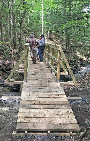
After 5 minutes’ walk from Old Spencer Road, a sturdy wooden bridge comes into view as you cross onto the Huntington Hill Wildlife Management Area.
Pause on the bridge to admire both the workmanship and the partnership that built it in May-July, 2017. A determined team of 20 volunteers, led by Hugh Mellert and the Hanover Conservation Commission’s Trails Committee, built the bridge with permission of the private landowners and help from the Upper Valley Trails Alliance, Hanover Public Works, Hanover Conservancy, Cardigan Mountain Highlanders, DHMC, neighbors, and hikers who happened by and jumped in. Funds for materials were donated and the 250 person hours of labor were free. This new bridge replaces one that’s been gone for 50 years, and provides a safe and valuable connection to the network of trails on Huntington Hill.
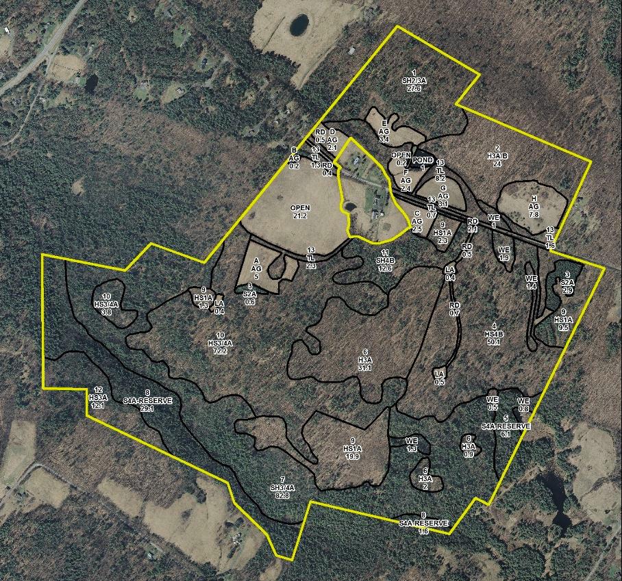
Huntington Hill Wildlife Management Area (outlined in yellow on this forest stand map) is managed for recreation, timber, and wildlife habitat. The NH Fish and Game Department holds a permanent conservation easement on 464 acres of privately owned land here, and also on a 31-acre piece connecting it to Hanover Center Road, where the Hanover Conservancy holds a secondary easement. Forests and vegetation cover are highly variable, with deciduous, mixed, and coniferous forest types. Hemlocks dominate the brook valley (lower L). Much timber stand improvement has been done over the last 40 years under the guidance of professional foresters.
Now turn your attention to the brook itself, and the fascinating variety of rocks composing its bed. Water-worn granite alternates with leaves of uplifted, slanted sedimentary rock that speak volumes about the deep geological history of this place.
Two trails meet at the far end of the bridge. Bear L onto the wider of the two (you’ll come back on the other one) and head steadily uphill through a pine/hemlock forest. Faded pink flagging marks the route.
About 10 minutes’ walk from the bridge, you reach the top of a rise where the Barnes Trail comes in at L by two large white pines. Another wooden sign with yellow lettering confirms your location. Continue straight for Goodfellow Meadows. Just ahead, another trail junction is visible. You’ll take that path on your way back.
15 minutes’ gentle steady walk uphill from the bridge, a trail comes in at R. Continue straight toward the opening that appears ahead. An orange diamond with arrow is posted at L, guiding your way forward.
Pass briefly into a brushy wildlife opening of berry bushes and popple. Think like a bear and keep an eye out for ripe fruit before reentering the woods. Places like this are also excellent habitat for hares.
In 6 more minutes’ walk, arrive at an open meadow bounded on the far side by a stately line of trees. A minor trail comes in at R – you’ll be returning on that trail to this point later.
Walk straight through the meadow, a stark contrast to the piney woods below. The meadow is filled at this season with golden black-eyed Susans and goldenrod, white yarrow and Queen Anne’s lace, and deep blue cow vetch among the grasses. Wildlife appreciate openings like this, vestiges of the much more open agricultural landscape that once existed here in New Hampshire. Listen for the conversational trill of the song sparrow.
Nearing a small red maple at L, note the barely perceptible shift in the tilt of the land beneath your feet. You are crossing the watershed boundary from Slade Brook behind you to the watershed of Pingree Brook, ahead.
As you approach the wall of tall trees at the far end of the meadow, a break in the trees appears and you arrive at an opening in the stone wall. Beyond stretch a grand, wide, rolling hayfield and wonderful views to the west and northwest. On the day we visited, newly mown hay was being turned to dry and the air was full of its sweet scent. While a woman driving a tractor was managing this task today, we could easily imagine a horse drawn tedder (R) doing the job a century ago.
While it’s hard to keep your eyes off the distant horizon, wrest them away to the stone wall close by. Among the larger stones are many smaller fist-sized ones, clues that the land growing grass today was once cultivated, prompting the farmer to remove and dump here any small stones that might damage his equipment or discourage seedlings.
Turn R and head up along the edge of the hayfield close to the tree line.
You’ll pass another break in the stone wall, but continue until the 19th century barn comes into view and you reach a sturdy post carrying a bluebird house and the familiar orange diamond with arrow. Views are even broader here. Imagine a time when these hills were 85% open sheep pasture and cropland, rather than 85% forested. In 1840, when Hanover’s human population was about 2,600, its sheep population was 11,024!
A low yellow-painted iron post by the stone wall marks your turn back into the woods here. Turn R again onto a well-worn path that follows the wall back in the direction you just came. From this vantage, it’s easy to read the former farming use in the strands of barbed wire laying over wider sheep fencing. A line of fine old maples punctuates the wall, testifying to the passage of time on this farm.
As the trail swings gently up to the L, sharp eyes will find the hood of a 1930s-era truck, another remnant of farm days past. The trail moves away from the field and wall and back into the Slade Brook watershed. Continue straight and head WSW and eventually S, gently up. Occasional flagging appears at R.
15 minutes from the field, an opening appears through the trees; just before reaching it, turn R onto a narrower trail just past a handsome straight-boled red oak at R.
A few yards later, this link ends at a T; turn R.
3 minutes later, you arrive back at the first open meadow. Look for the small red maple dead ahead. Stop and admire the views you couldn’t see when you first traversed a lower part of this field.
Paths diverge here following the forest edges; you bear L, noting blueberry bushes at your feet, and pass along the edge of the meadow before quickly regaining the shelter of the woods.
5 minutes later, rejoin the trail at the end of the meadow. Turn L and retrace your steps downhill, bringing you in 10 minutes back to the yellow painted sign for the Barnes Trail. If you’re in a very big hurry, you can take this trail to return directly to your car (about 12 minutes), but you’ll miss a nice treat (20 minutes, not including time lingering by the brook).
To continue your hike, turn to face uphill and after 15-20 paces, turn R onto a new trail that largely follows the contour after a short log crossing of a small drainage. The trail soon takes on the look of a very old woods road, with a sunken bed just wide enough for a cart. The old road starts down into Slade Brook’s hemlock-shaded valley.
5 minutes from the last junction, you reach the brook at a footbridge constructed in September, 2018 by Hanover Trails Committee volunteers and the public-spirited landowner. Today, our route keeps us on this side of the brook.
Turn R and follow the brook down through its steep-sided valley, noting how tree roots hold the streambank in place. In some places, you can see where the brook makes several channels during high water, and then recedes to the lowest of them as waters subside, rearranging its bed every time. A thrush’s song plays a duet with the water’s music.
Watch closely for a shift in the trail up to the R under a tipped hemlock as the trail leaves the brookside to avoid a section of uplifted ledges. Occasional orange arrow signs point the way, but you need only to keep the brook on your L. It seems a privilege to be accompanying this little brook on its trip to the Connecticut River, spilling over tiny waterfalls and enlivening occasional pools as it tumbles on its wood-strewn way. If you brought a snack with you, find a likely looking rock perch to enjoy it now.
6 minutes from the old crossing, return to the new bridge. The trail you took on the way out comes in at R.
Past the bridge, you’ll know when you’ve returned to DHMC land when logging slash appears by the trail. Limbs and branches are left behind to return nutrients to the soil and feed the next generation of trees.
3 minutes from the bridge, arrive again at Old Spencer Road. Turn R and head down 4 minutes to the lower bridge and your car.
Please respect the generosity of these landowners by leaving no trace of your visit and enjoy the memories and photographs you take home.
Turn R on Ruddsboro Road and continue to end on Route 4
Turn L on Route 4, drive 1.6 miles to Enfield Village
Turn L onto Maple Street; bear L at junction with May Street.
Drive 3.1 miles to the well-marked Baum Conservation Area entrance (1.7 mi. past Hanover-Enfield line).
What You Should Know
This is a hike for confident hikers with good trail skills. The trails are not the well-beaten paths you find at Balch Hill or the Appalachian Trail, which is part of the adventure. Bring a compass.
Some of the route follows grassy former skid trails; anticipate insect hitchhikers and do a tick check.
Foot travel only. Dogs welcome if under close control. You’ll pass prime porcupine habitat – we know from experience.
The route visits the Baum Conservation Area and the Dana Forest and Pasture Natural Area, parts of a 3,800-acre block of protected high-elevation wildlife habitat on Moose Mountain.
Hiking Directions
Begin your hike at the large triangular flat rock at the SW edge of the dirt parking area, after familiarizing yourself with the trails depicted on the posted entrance sign. You’ll be touring most of the 1.6 mile Blue Loop today, with a couple of additions.
To protect mountain wildlife habitat next to the Dana Forest and Pasture Natural Area and to offer public access to the trails you’ll be exploring, Dartmouth alumnus and outdoorsman Jim Baum and his wife Carol purchased this 239-acre area and gave the Town a conservation easement on the land. Jim worked with the Upper Valley Trails Alliance to improve the trails.
Start up through the trackless meadow, aiming for a point at 10 o’clock on the surrounding tree line. Soon a bare bit of smooth ledge appears with a small cairn to reassure you. Look for a yellow diamond sign with an arrow at the edge of the woods. Here, you bear R (not L) onto a mowed path.
An old skid trail turned hiking trail, the path soon begins to ascend gently but steadily, with mosses and herbaceous plants underfoot. Continue past a wide trail leading back down to the meadow. Shrubs such as a native honeysuckle and spiraea line the way. You can tell the soils here are moist, receiving subsurface water from upslope, as the path is carpeted with water-loving sedges. The curious fruiting body of the most common one looks like a pudgy green porcupine or blowfish. It looks prickly, but it’s not.
About 18 minutes from your car, the trail bears R and levels out. A blue arrow confirms you’re on the Blue Loop. Waist-high bracken fern grows exuberantly. If a deerfly has discovered you, thwart it by joining the Order of the Bracken – pick a frond and wear it upside down on top of your head! Deerflies are programmed to swarm around the highest point of their prey – and will hover at the top of the fern stem.
4 minutes from the blue diamond, look for yellow and blue diamonds on a tree at L. The trail swings L and moves through a thick young forest of pole-sized trees 1-3” in diameter. Grouse enjoy this habitat and you may suddenly flush one, startling both of you. Listen for the liquid notes of a wood thrush.
Another 4 minutes’ walk brings you to a clearing where a yellow arrow points L. You bear straight toward an opening filled with sun-loving, fragrant, hay-scented fern. Foresters don’t like this fern (or bracken) because it tends to quickly colonize forest openings, shading out any tree regeneration they encourage.
The trail moves gently up and curves L and R, ducking in and out of fern openings. As you ascend, now heading N, note the change in the woods. Here, older yellow birch and beech dominate the bony land. A few dips in the trail remind you that it was built as a logging trail with water bars to prevent erosion.
In 10 minutes, pass a pool teeming with tiny life. Just past it, the trail heads downhill.
Watch for a blue arrow on a small gnarled maple at L, directing you R as the trail gently curves.
The trail becomes narrower, with a few twists and turns, but if you trust your feet, it’s easy to follow.
5 minutes past the pool, look for a junction with blue arrows pointing L and R. The Blue Loop heads R, straight downhill and back to the meadow and your car. We have more to discover, so look ahead for two orange diamonds at 11 o’clock. Head this way and cross a tiny drainage. This is a good place to look for wildlife tracks. Moose, bear, fisher, bobcat, fox, coyote, deer, porcupine, and squirrel are possibilities!
The trail has now transitioned to a more familiar woodland path. Follow the irregularly spaced orange diamonds, interspersed with blue flagging. In some places, blue diamonds are posted for viewing from the other direction. The trail moves gently and steadily up through mature northern hardwood forest.
9 minutes from the last junction, a large bark-less, sun-bleached tree trunk has fallen across the trail. Pause to cross it and note an orange diamond on the L and just ahead, a constellation of signs. You have arrived at the Dana Forest and Pasture Natural Area, a 132-acre parcel owned by both the Town of Hanover and a member of the Dana family.
At this major junction, you have a choice –a 20-minute detour to check out two ledges (10 minutes if you just bag the first one) and soak in some views, or continue in the woods.
Optional Visit to Moose Mountain Ledges (1/3 mile each way)
Turn L at the wooden sign and up a short steep section to a mossy ledge. This is part of the Orange Diamond Ridge Trail, built by a daring snowmobile club in the 1970s. The trail runs along the spine of Moose Mountain from Enfield to the South Peak, where it meets the AT. The Hanover Trails Committee has decided to rename it the Tom Linell Ridge Trail, after a dedicated long-time trail maintainer. The snowmobiles never returned.
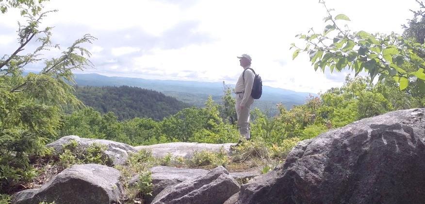
Arrive at the first of two open ledges where views open up to the E. At 1 o’clock is the bony knob of Mt. Cardigan. Keep an eye on kids and dogs. A small cairn on the far side marks the trail’s return to the woods. Pass a nice colony of the small but stoic rock polypody fern.
Here, the Ridge Trail follows the boundary of two privately owned parcels – to the E is the Baum Conservation Area – you’re now following a trail that is parallel to but high above the one you just walked.
5 minutes from the first ledge, arrive at the second, larger ledge, with even broader views. From the highest part of the open rock, you can see distant Mount Washington at 11 o’clock. At 10 o’clock, the ridge of Moose Mountain stretches N beyond the communications tower.
To return, look for pink tape on a tree to locate the trail back. It becomes clear you’re hiking the very spine of this mountain, a watershed divide, with the Mascoma River valley off at R and Mink Brook valley at L.
Return to the first ledge and follow a blue arrow to return to the trail junction.
Hike Continued
Back at the trail junction, retrace your steps to the fallen bare tree across the trail. Continue another 10 paces to a yellow sign at R for the Baum Conservation Area. At L, an orange sign with an arrow directs you to turn L onto the Ridge Trail, which appears as a smaller side trail.
Soon the Ridge Trail swings L and slabs along the contour before heading gently downhill. Note the bristly white pine at R that has received the attentions of pileated woodpeckers. The forest floor undulates with
the mounds and pits that betray long-ago blowdowns.
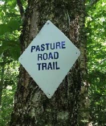
5 minutes after turning onto this trail, arrive at a junction. Bear R to follow orange flags, about 20 yards to a small hollow. Here an orange sign at L reads “Orange Ridge Trail” and at R, a white sign indicates “Pasture Road Trail.” Note the town’s blue and white trail blazes on a birch at L. This doesn’t look much like a road, but it follows, more or less, the route of a long-abandoned early “highway.”
Turn R to take the Pasture Road Trail, which is marked with blue-white blazes and occasional blue flagging. Here, the trail is uneven and narrow but well-marked.
6 minutes from the junction, you come upon a startling sight – the imposing corner of a stone wall with a yellow pin protruding from its base – boundary markers from the 19th and 21st centuries colliding. The wall is big and blocky and encrusted with lichen. It marks the northernmost corner of the Baum Conservation Area. After the terrain you’ve just been over, it’s hard to imagine building a wall to keep sheep here – especially a wall like this!
The trail continues L of the wall’s corner. Keep the wall on your R and a sharp eye out for painted blazes and blue flagging. The wall oddly ends, then after the trail twists near an outcrop, a section of wall appears again. There’s a nice growth of bunchberry and lowbush blueberry on the forest floor.
8 minutes from the pinned wall corner, the trail parts company with the wall, which heads downslope. You continue straight, following blazes carefully. A short section of wall shows up again (what was the wall builder thinking?). Keep following the blue flagging and trust your feet.
3 minutes later, bear R downhill onto a clearer path, down to a flat in a hemlock grove. Here, the trail bears R and is marked with simple blue painted blazes. Arrive at an opening with a dramatic view up to the ridge you may have just visited.
The trail continues on a narrow, rocky path for another 5-7 minutes arriving abruptly back at the Baum Conservation Area’s Blue Loop Trail, the now-familiar wide grassy path.
Turn L onto the easily followed trail and soon cross a streambed. Depending on recent weather, it may be dry, but it still has a watershed address! It’s an unnamed tributary of Lovejoy Brook, a tributary of the Mascoma River. We think it should be Baum Brook.
10 minutes after joining the Blue Loop, cross another tiny stream. A path comes in at L – this leads to the Baum Cabin. Continue straight, head slightly uphill, and 2 minutes later you’re back at the meadow with your car in sight. As you head down to it, don’t forget to look for wild strawberries in the grass!
Note – Baum Cabin, 1/3 mile north of the parking area, is open to all by reservation with the Dartmouth Outing Club. Jim and Carol Baum gave the cabin to the DOC in 2008, thoughtfully including funds for its upkeep. The two-room cabin sleeps 6.
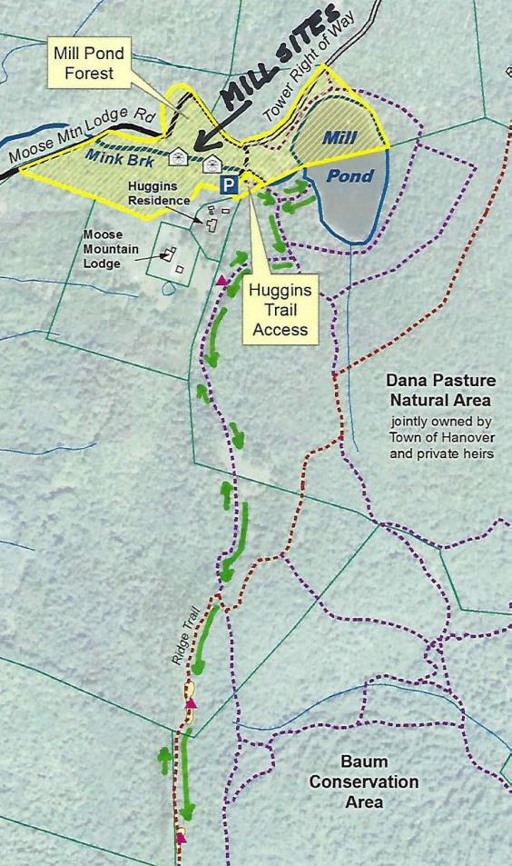
Turn R just past large red barn on R, onto Moose Mountain Lodge Road (not marked)
Drive 0.8 miles to top of road. Park at the marked trailhead parking area just past the beaver dam.
What You Should Know
Foot travel only. Dogs welcome if under close control.
Bring binoculars and bird book for viewing waterfowl on Mill Pond and exploring distant views.
This hike celebrates the history of Moose Mountain Lodge and explores the wild ridge of the mountain. We will view the former Lodge site from an overlook; please note that the site is privately owned.
The route visits part of a 3,800-acre block of protected higher-elevation wildlife habitat on Moose Mountain.
The hike ends with an optional visit to protected 18th century mill ruins on the steep mountainside.
BRIEF DIRECTIONS
Begin at the sign reading “Mill Pond Forest & Huggins Trail Access.”
Bear L at first trail junction to visit Mill Pond
Return to trail junction and turn L onto Pasture Road
Turn R onto Baboon Bypass, cross drainage, and reach first views
Continue on trail to second pasture and third pastures and cross stone wall
Bear R at arrow, head downhill, and shortly after, turn L at arrow
Bear R at sign parallel to the trail indicating the Orange Diamond Ridge Trail. Head up a short steep section to a mossy ledge.
Continue to second open ledge.
Retrace your steps to return to your car.
Hiking Directions
Begin your hike at the sign reading, “Mill Pond Forest & Huggins Trail Access.” To forever ensure public access to the network of trails you’ll be exploring, the Shumway and Huggins families donated conservation easements on this area to the Hanover Conservancy in 2016.
Cross a small drainage and note the series of small beaver ponds at L. By late 2017, the beavers left after many years of entertaining their neighbors with sightings of cruising kits and evening tail slaps on the water, as well as plugged culverts and “free-range forestry.”
The thread of infant Mink Brook has reappeared with the lack of diligent management by these aquatic engineers.
Arrive at the first trail junction and bear L. Within 15 paces look for a cellar hole at L. This was the high-elevation c. 1800 home of miller David Woodward, who built the dam on Mill Pond and an impressive sawmill and gristmill on the steep falls of Mink Brook below where you left your car (optional visit at end of this hike). Woodward’s house was probably larger than the modest cellar hole, which, in the days of hand digging, must have presented a challenge to build.
Mill Pond beavers; photo by Kay Shumway
Continue on the path a few minutes further to a bench at the pond shore. It’s time for a picnic, or at least to pull out the binoculars! Ten-acre Mill Pond is the highest water body in Hanover and the primary source of Mink Brook, the town’s largest stream. Set in a saddle on the mountain ridge, it may have originally been a small pond or perhaps a marsh. Around 1800, Woodward built a drylaid stone dam (just out of view at L, beyond the spruces) to raise the water level some 6-8 feet (it has since partly silted in). Beavers later took over and have been managing the pond off and on, ever since. Today, the entire shoreline remains undisturbed: Hanover Conservancy easements protect the N side with the Dana Pasture Natural Area on the S (co-owned by the Town of Hanover and a Dana heir).
Directly across the water is an impressive beaver lodge. Scan the pond’s surface for waterfowl and other birds. On the day we visited, three male mallards were holding a bachelor party at the pond.
Retrace your steps to the cellar hole and trail junction. At this time of year, violets are in bloom on the forest floor and you may spot the cheerful red of partridgeberries.
A sign for Pasture Road and a green moose mark the trail junction. Turn L; soon you’ll see the old stone wall marking this Class VI road. Where Pasture Road once met Moose Mountain Lodge Road is anybody’s guess – our bet is the area under the beaver dam.
Pass by the first gap in the wall, which leads to a private home, and look for a second gap marked with a sign for “Baboon Bypass” a few yards beyond the wall. Turn R here. This short and somewhat indistinct trail leads W toward your next destination, across a small drainage. Blue sky appears ahead and an arrow on a barbed-wire-garbed tree directs you to swing L into an opening.
Arriving in an old pasture (first of three), leave the path and head through low brambles and blueberry bushes toward a big pine and two old fence posts. It seems all of central and southern Vermont is spread before you, with sharp-peaked Killington presiding.
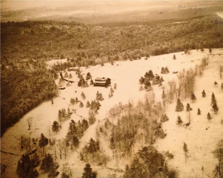
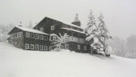
It seems all of central and southern Vermont is spread before you, with sharp-peaked Killington presiding. For 80 years, just below the brow of this field, stood Moose Mountain Lodge, an icon in the Upper Valley and legend in the ski world. The Lodge is now history, having been removed in the last few years, but we’re going to tell you all about it!
Lodge, pastures, and ski slopes, 1949
Let’s start with long-time owner Kay Shumway’s recollections: “The Lodge is a big old comfortable log building perched high on the western side of Moose Mountain. It has survived 80 years of snow, sleet, ice, wind, and lightning. The weather comes across the Connecticut River Valley and sweeps up the mountain, wearing away at the log surfaces like sandpaper. Sometimes the wind gets unbearable with its relentless buffeting. We often remark that it’s almost like living on a ship at sea.”
The Leslie brothers built the lodge in 1937-38. They were identical, inseparable twins – when one came to Dartmouth, the other had to come too! Bill Robes was teaching skiing then and the boys were hooked. Robes, who married into the Dana family, he said he knew of a place where they could build a ski lodge, and the rest is history.
The Lodge opened in 1938 for downhill skiing complete with rope tows and skiing on cleared slopes below. There was even night skiing on a lighted slope, which according to Kay was not too successful. The Lodge primarily served Dartmouth, housing college guests and students’ dates. Back then skiers careened down the mountain’s sunny west slopes on wooden skis. The road up to the Lodge was part of the adventure. Most who arrived by car parked at the base of the mountain and used a crank telephone to summon the Lodge’s Ford woody station wagon for a ride up the hill.
From 1943-45, the Lodge closed as gas rationing during WWII curtailed driving for pleasure and cut off fuel for the tows. It reopened from 1946-49 but was soon empty and vandalized. In 1955, Bob Jones bought the abandoned Lodge and nearby cottage as a boys’ summer camp. Camp Moose Hi ran for three years until Agnar and Anah Pytte bought the Lodge and Elisha and Anne Huggins the nearby cottage. John and Mary Clarke acquired the Lodge in 1972, turning it back into an inn for cross-country skiers and cutting some of trails we still enjoy today.
The Lodge in 1975
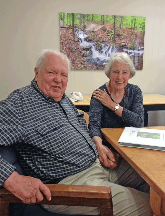
Three years later, Peter and Kay Shumway visited in a snowstorm. At the time, Peter was in the lumber business in New York and Kay taught in a Head Start program. Peter’s father had been a ski jumper at Dartmouth (Class of 1913) and when he and some friends skied the 25 miles to Mt. Moosilauke, people would stop them and ask what they had on their feet. The Shumways happily bought the Lodge and it continued to host in the back country skiing tradition.
The Shumways welcomed guests for the next 35 years, retiring in 2011. Kay recalls, “Inn-keeping on our beautiful mountain allowed us to live in this peaceful place in isolation while still meeting interesting people.”
In 1985, the Shumways purchased a 313-acre mountain tract just N of the Lodge to keep it from being developed. Their forester, John O’Brien, helped them return its forest to health after prior heavy logging, always with an eye to ski trail potential. In 2017, these public-spirited landowners conveyed a permanent conservation easement on the Shumway Forest to the Hanover Conservancy, protecting public trail access and high elevation wildlife habitat forever. We celebrated with the entire Moose Mountain Lodge family and many friends on a sunny Saturday in July.
Peter and Kay Shumway after signing the Shumway Forest conservation easement, June 2017
The lodge interior was even more wonderful than you imagine. Log ceiling beams, a sunny comfortable living room filled with rustic handmade log furniture, Kay’s baby grand piano, and drifts of hand-dyed wool for her spinning projects surrounded a huge cobblestone fireplace that featured a granite millstone above the hearth (more on that later). The dining room spanned the NW side, with another fireplace and a handmade dining table so long you can just imagine hungry guests gathering around it after a great day on skis. Behind was an efficient yet delightfully old-fashioned kitchen with everything close at hand, including Kay’s own Moose Mountain Lodge recipe book. On the N side was the ski shop with rows of skis hanging from a rack, ready for waxing. A welcoming porch spanned the entire W side, with log settees beckoning you to relax and take in the breathtaking view and spectacular sunsets.
Up the stairs under the watchful eyes of a mounted moose head you’d find a warren of cozy guest rooms with log beds, some made by Kay and Peter themselves. Down the hill were a large fenced vegetable garden, goat shed (Kay kept Angora goats for their fleece), and small sugarhouse.
Now it’s time to enjoy some of the trails the Shumways and their former neighbor, Elisha Huggins, long maintained. Return to the path and continue uphill to a second, smaller clearing adorned by white birches. Follow the path back into the woods, guided by small wooden arrows. Soon you’ll arrive at a third pasture, the largest of all. Head uphill toward a moose sign with orange highlights posted on a birch.
These pastures, occasional clumps of juniper, and the fragments of barbed wire on fence posts recall the land’s history as the Dana Farm’s summering grazing grounds. The Dana family farmed this area since the late 1800s. Today, the red barn still stands on the E side of Old Dana Road and the early white farmhouse migrated from its original site across the way to the hilltop above. Into the 1960s, the family drove their cattle up the mountainside to graze here during the summer. After grazing stopped, Elisha Huggins kept the pastures open for skiing and views, using a hand scythe!
A low stone wall among the birches marks the boundary with private land. Continue S toward a large ash bearing an arrow pointing R. After a short downhill, another arrow + moose sign directs you to turn L. Take the path through the woods a short distance to a trail junction.
A sign at R, parallel to the trail, indicates the Orange Diamond Ridge Trail. Bear R and up a short steep section to a mossy ledge.
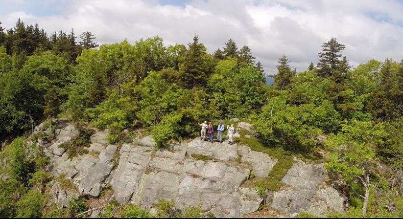
Ten minutes’ walk from the last pasture, you arrive at the first of two open ledges and views open up to the E. Keep an eye on kids and dogs. A small cairn on the far side marks the trail’s return to the woods.
Here, the Ridge Trail follows the boundary of two privately owned parcels – to the E is the Baum Conservation Area, owned by a local Dartmouth alumnus with a keen interest in trails and conservation. Pass a nice colony of the small but stoic rock polypody fern.
Five minutes from the first ledge, arrive at the second, larger ledge, today’s turn-around point. Time to corral kids and dogs and pull up a stony seat among the lowbush blueberries to drink in the view (and some water). At 1 o’clock is the bony knob of Mt. Cardigan. If you stand on the highest part of the ledge, you can see distant Mount Washington at 11 o’clock.
At 10 o’clock, the ridge of Moose Mountain stretches N beyond the communications tower. From here, you get a fine view of the mountain’s E profile and realize that, like Holt’s Ledge and so many others in New England, it is a roche moutonnee or sheepback, shaped by the passing of the glacier. The glacier abraded the NW side and plucked rocks from the opposite slope as it ground its way from NW to SE. In this view, dark patches of evergreens to the R of the tower mark the steep SE side.
To return, pink tape on a tree helps you locate the trail back. It becomes clear you’re hiking the very spine of this mountain, with the Mascoma River valley off at R and Mink Brook valley at L.
Returning to the first ledge, admire the view of Cardigan before continuing on, following a blue arrow.
At the trail junction, yellow signs point R to the Baum Conservation Area (to explore another day). You turn L to retrace your steps toward the pastures.
At a bent yellow birch, a sign at L directs you to turn R; shortly after you’ll turn L at another arrow. Soon you’re back to the birches and the upper Dana pasture. In June, white five-petaled strawberry flowers decorate the ground under your feet.
Continue gently downhill to the last pasture, above the site of the Lodge. See if you can spot the white hamlet of Hanover Center in the distance, to the R. You can see why this village never fulfilled its intended destiny as the hub of Hanover – it’s on a hilltop and there’s no running water!
Take the path back into the woods – avoid the trail that comes in at L from a private home – and return to Pasture Road. Turn L past the stone wall and then L again at the junction by the cellar hole. Ten minutes from the last overlook, you’re back at your car.
Optional Mill Site Visit (10 minutes)
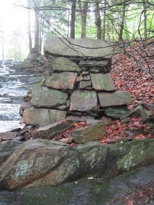
Hidden in the woods are remains of a late 1700s saw and grist mill. They are very close by but invisible unless you make the short scramble through the woods to see them.
Walk back down Moose Mountain Lodge Road to a telephone pole opposite the gated entrance to the tower right of way. Turn L and bushwhack back the short way to the stream. You’ll soon pick up an old cart path on the near side. Take this down along the brook, admiring the cascades, to a series of angular piles of rock. Towers rise on either side of the brook. More can be seen farther downstream.
We marvel at how David Woodward managed to build these structures in such a steep ravine around 1800, his only tools likely being a pair of sturdy oxen, ropes, a chisel, and a native understanding of physics. In his 1982 anthropology paper, Dartmouth student Tom Slocum suggests that Woodward used the cubic
blocks of native schist to build an undershot-type mill that most likely functioned to saw wood and grind grain. Water stored in the pond above could be released to provide enough flow to operate the mill. At some point in its history, the mill operated only during the spring freshet and only as a sawmill.
The 1930s builders of Moose Mountain Lodge found their fireplace ornament here amid the ruins of Woodward’s mills. These historic sites are now specifically protected from further disturbance by the Hanover Conservancy’s Mill Pond Forest conservation easement.
Continue down the brook-side cart path to the last set of ruins. The path appears to end here; retrace your steps to return to your car.


 Driving Directions
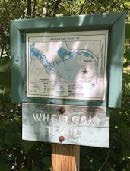 A few paces beyond the turn, look for the Wheelock Trail just before a fire hydrant.
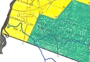
 About 15 minutes’ walk from Buck Road, you reach a beautiful rocky gorge. The trail briefly becomes indistinct on the slope but picks up later. Take a moment to visit the water’s edge and discover a lovely pool behind a low dam. This dam was built in the 1920s to create a swimming hole for a seasonal cottage once owned by the Tanzi family. The cottage is now gone, but a nearby private residence remains on the opposite bank. Continue west on the Wheelock Trail.
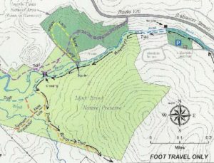 Five minutes’ walk past the boulder brings you to a recently abandoned stream channel. Before Tropical Storm Irene, Mink Brook ran through this now nearly dry sandy area, but the August 2011 surge tore a new channel slightly north, where it now flows except in times of very high water. The trail heads toward the log crossing built in 2009. Just before the bridge are signs of erosion that began with Irene and continues today – a hemlock hangs out over the water, its roots exposed, and on the far side, the brook is scouring the north bank. Nearby at L, ferns occupy the swale of yet an earlier abandoned channel. This is a pretty busy place!
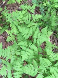 At R, pockets of ferny wetlands adorn the forest floor. It is easy to imagine how useful they are as sponges during heavy rains, holding back stormwater and protecting the brook from flooding and erosion.
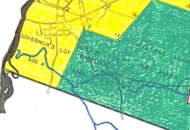
 Driving Directions
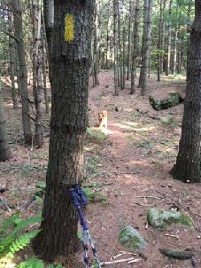 Don’t be dismayed by the steep path that suddenly appears– the rest of the hike is gentle and rolling. Follow the yellow blazes into the woods.
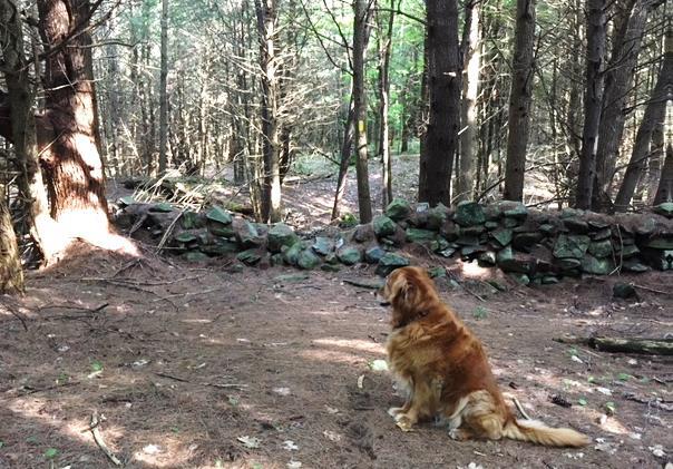
 When leaves are off the trees, you can also see the Adams Farm house, a late 18th/early 19th century white cape with a single chimney. This was home to the family that once owned the farmland you are exploring today. Hudson purchased land that included the Adams barn – and then burned it down.
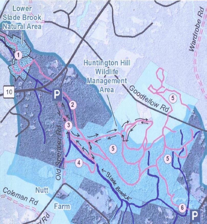

 As you approach the wall of tall trees at the far end of the meadow, a break in the trees appears and you arrive at an opening in the stone wall. Beyond stretch a grand, wide, rolling hayfield and wonderful views to the west and northwest. On the day we visited, newly mown hay was being turned to dry and the air was full of its sweet scent. While a woman driving a tractor was managing this task today, we could easily imagine a horse drawn tedder (R) doing the job a century ago.
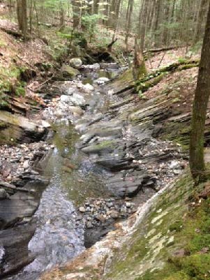 5 minutes from the last junction, you reach the brook at a footbridge constructed in September, 2018 by Hanover Trails Committee volunteers and the public-spirited landowner. Today, our route keeps us on this side of the brook.
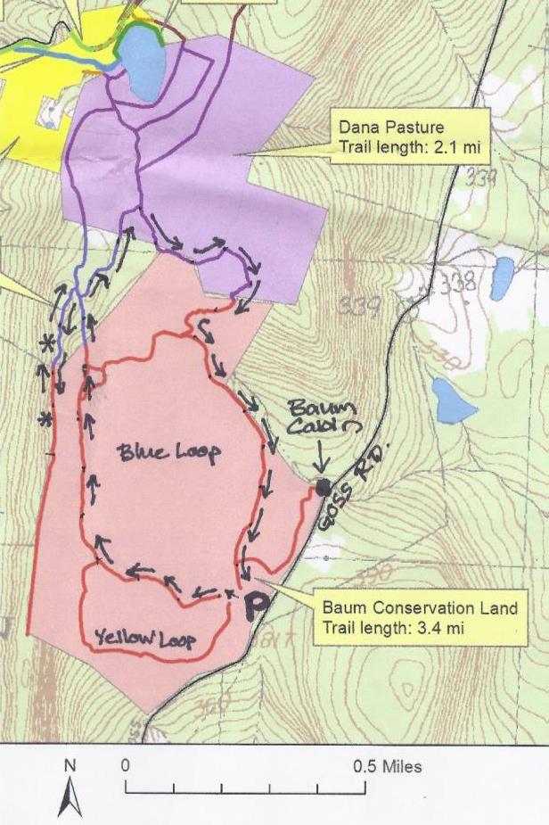

 5 minutes after turning onto this trail, arrive at a junction. Bear R to follow orange flags, about 20 yards to a small hollow. Here an orange sign at L reads “Orange Ridge Trail” and at R, a white sign indicates “Pasture Road Trail.” Note the town’s blue and white trail blazes on a birch at L. This doesn’t look much like a road, but it follows, more or less, the route of a long-abandoned early “highway.”
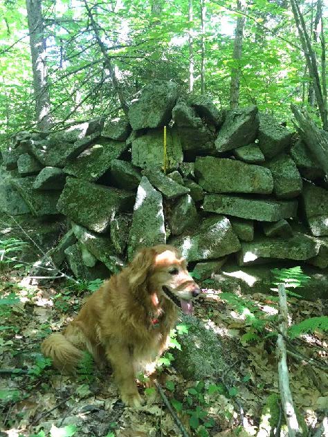

 Hidden in the woods are remains of a late 1700s saw and grist mill. They are very close by but invisible unless you make the short scramble through the woods to see them.