Driving Directions
- From downtown Hanover, head N on Lyme Road (Route 10)
- 6 miles after passing Kendal, turn R on Goodfellow Road
- Head uphill for 0.7 mile; pavement ends near historic white farmhouse on R
- Park in pull-off on L (north) side of road near gate. A sign reads “foot travel welcome.”
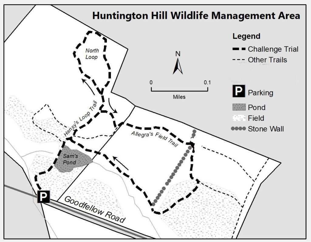
What You Should Know
- Today’s hike is a pair of loops on permanently protected, privately owned land. Please respect the generosity of landowners who provide public access, and pack out your trash.
- Much of this route travels over wide and less-used trails – old farm lanes and mowed meadow paths – allowing for ample physical distancing while enjoying the outdoors.
- Dogs must be under your close control. Please pick up after your pet.
Brief Hiking Directions
- Walk around the gate and follow the mowed path to Sam’s Pond.
- Beyond the pond, bear L at a fork
- Bear L at another fork labeled “Hansy’s Loop”
- Bear L at another fork with arrows pointing both ways and sign reading “Hansy’s Loop”
- Returning to this point, return on the trail traveled earlier but turn L just past a large fallen tree on R
- Turn L at T at a stone wall to follow Allegra’s Field Trail
- Cross a second stone wall and bear R
- After reaching a second meadow, bear R and down to the pond
- Turn L to cross the pond’s dam and return to your car.
The Full Story
- Begin by walking around the gate and following the mowed path as it winds through a pleasant meadow.
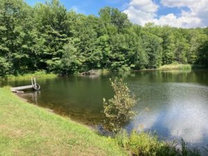
- An expanse of water appears ahead – you’ve found Sam’s Pond.
- Pause by the small dock for a moment to contemplate the major conservation success that allows you to visit today. You’re walking through 83 beautiful acres that are part of the permanently protected Huntington Hill property. Dr. Sam Doyle purchased this land in 1991 and conveyed a conservation easement on six parcels, including this one, to the NH Fish and Game Department. On the S side of Goodfellow Road, the property spans another 417 acres. Other adjacent conservation lands, including the Moister Meadow (20 acres, easement held by the Hanover Conservancy), the Mudge land (8 acres, easement held by Fish & Game) and the Nutt Farm (207 acres, easements held by Society for Protection of NH Forests) bring the total of protected, connected wildlife habitat to a stunning 735 acres. (See map on next page, where these areas appear in dark green). Today, Huntington Hill continues under a new family, with the original protections intact (see p.4).
- Continue across the earthen dam to the far side, and bear L through another meadow. The coarse fronds of sensitive fern at L tell you that area is damp without the need to feel the soil. Drier parts of the upland meadow are studded at this season with the nodding white flowers of Queen Anne’s Lace. Continue straight as a second mown path comes in at L. Your trail soon swings to the R and up into the woods, returning to the N edge of the meadow, where the pond comes back into view. At the far edge, look L for a yellow-highlighted sign reading “Hansy’s Loop.”
- Bear L here, walking up and away from the pond. After a few minutes, an orange arrow guides you to bear L.
- A large blowdown at L gives an intimate view of the fallen tree’s root system and the light soil in which it grew.
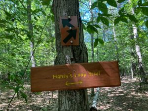 5 minutes from the last junction, arrive at another fork with arrows pointing both ways, and bear L.
- Travel gently down through a mixed age forest of pine, northern red oak, and other hardwoods. These are taking the place of an earlier stand of white birch, whose fallen members litter the forest floor, returning nutrients to the soil. Look for a variety of club mosses thriving here – ground cedar, shining clubmoss, and others. The strange and ghostly white stems and flowers are Indian Pipe, a wildflower – not a fungus – that takes food from tree roots rather than making its own with green chlorophyll.
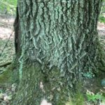 As the trail swings R and to the SE, you’ll encounter some much larger trees. Sharp eyes will spot fragments of old barbed wire caught in their trunks and realize these are boundary trees – allowed to grow to such size because neither neighbor dared cut them, and they were serving as useful fence posts at a time when the landscape was more open. One oak looks to be at least 30” in diameter at breast height. 7 minutes from the last fork, the trail swings R again at a huge double-stemmed red oak marked with a red boundary blaze.
- 3 minutes later, you’re back at the start of Hansy’s Loop. Retrace your steps back down the hill for about 45 paces; just past the fallen tree at R seen earlier, turn L onto a less distinct, unmarked trail.
- This trail soon reaches a low stone wall, where you turn L and walk gently uphill for a short distance past the end of the wall. This is the first reminder that this wooded land – and most of Hanover – was once open sheep pasture. After all, nobody builds stone walls in the woods! In 1840, Hanover had 2,613 human residents and a startling 11,024 sheep.
- The trail narrows and rises more steeply to another impressive oak, then flattens out. Soon, arrive at a larger stone wall. Just beyond, a sign announces “Allegra’s Field Trail.”
- 3 minutes’ hike from the last stone wall, reach another sunny meadow. In your view at about 2 o’clock is Huntington Hill, at 1247’ a perfect twin of the hill you just hiked around.
- The meadow’s mown path forms a T: turn R, noting the lowbush blueberries carpeting the area. This must be a very happy place for bush-surfing bears in July.
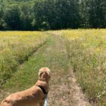 Head down through the field amid the sunny heads of goldenrod. There are many species of this yellow aster-type flower in northern New England, but did you know that there is also one called silverrod? Its white flowers are reminiscent of moonbeams.
- Huntington Hill’s variety of habitats – shady diverse forest, sunny meadows, open water, and the edges where they meet – are more important than you might think in keeping Hanover’s landscape resilient to the effects of climate change. Why? Connectivity. Strategically located between the migratory pathway that is the Connecticut River and the uplands of Moose Mountain, Huntington Hill connects these
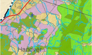 areas. It provides an important travel corridor for birds and other wildlife that need to move around, either seasonally to summer breeding grounds, or more long-term as the climate changes. If wildlife can move freely, their genes can too, meaning that their populations don’t become isolated, inbred, and therefore less healthy. In this map, dark green shows conserved and public lands; light green shows core areas for conservation focus, and purple indicates important connectivity corridors stretching from the river to the core (the star indicates today’s hike location.)
 - As you re-enter the cool woods at the foot of the same stone wall you recently crossed, note the heap of many small stones. These tell you that the land nearby was once tilled, and the farmer went to the effort to pick the stones and transport them here to spare his plow and give his root crops a fighting chance.
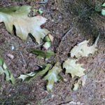 Walk along the contour on a wide old farm lane. Watch for acorns on the trail – they make wonderful food for wildlife but can act like ball bearings underfoot!
- 15 minutes from the top of the last meadow, arrive at the lower end of the first wall you crossed, and Sam’s Pond appears through the trees ahead at L. As you close your second trail loop of the day, note a large rhododendron, oddly out of place near the trail junction. It must have been planted – but by whom, and why?
- Watch the area carefully before stepping out of the woods. On the day we visited, a male Northern Harrier (formerly called a marsh hawk) sailed out over the meadow from the pond.
- At the lower field’s edge, turn L to the pond. Pause a moment to watch for wildlife – maybe the darting gymnasts of the air, dragonflies on the hunt above the water’s surface or resting on a blade of grass. Check the sediments at the water’s edge for tracks. Goldfinches chatter in the trees.
- Continue to the far side of the pond. At this season, your reward may include ripe blackberries on the briars that frame parts of the trail. This is one of many kinds of mast on which wildlife thrives here – blueberries, acorns, naturalized crabapples, and more.
- Follow the mown path to your car on Goodfellow Road.
Historical Notes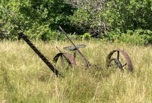
Goodfellow Road, linking Lyme Road with Hanover Center Road since at least 1855, takes its name from the Goodfellow family, from whom Dr. Doyle purchased the land in 1991. The Goodfellows arrived between 1893 and 1925.
In the 1850s-80s several generations of the Runnels family lived on and farmed on the land you visited today. By 1885, John Runnels was listed as a “wool grower” with 125 sheep on 196 acres. He had served three years in the Civil War with the 9th New Hampshire Volunteers.
In the 1880s-90s the Ingalls brothers, A.H. and Charles, occupied the big white farmhouse, barn, and 250 acres across the road. Also sheep farmers, they had an apple orchard of 100 trees, a maple sugar orchard of 200 trees, and 130 head of sheep. Back in 1855, the family of Andrew Huntington – he who gave his name to the property –farmed that land. Andrew, who probably built the 1780 farmhouse, served in the Revolutionary War with his brothers Christopher and Samuel.
Today’s owners feel viscerally attached to their property on Goodfellow Road and were excited to purchase conserved land from Sam Doyle with the promise to Sam that they would continue his focus and dedication to the land – maintaining and expanding the network of trails, promoting the property as a wildlife habitat, keeping fields mowed, and sustainably harvesting timber according to the Forest Management plan maintained by Jeff Smith of Butternut Hollow Forestry.
September, 2020


