Kendal and Rinker-Steele – Full PDF
 Driving Directions

- From Downtown Hanover, drive N on N. Park Street and turn R onto Route 10N. Drive past the golf course, through a rotary, past the Richmond School, through a smaller rotary, and past Kendal.
- Turn L at the entrance for Kendal Riverfront Park (drive for the former Chieftain Motel).
- Park in the gravel-surfaced lot. This area is open from dawn to dusk.
What You Should Know
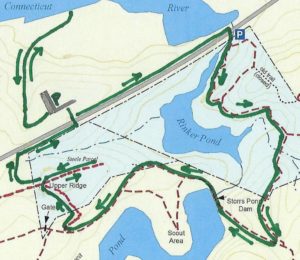
- Today’s loop hike visits the Connecticut River shore at Kendal Riverfront Park and then makes a loop through the Rinker-Steele Natural Area to Ferguson Field, and back along a short section of Route 10.
- You’ll be walking on lands owned by Kendal at Hanover, the Town of Hanover, and the Hanover Improvement Society. Conservation easements protect some but not all of this land.
- Trails have many short but steep up-and-down grades – you’ll get a good workout! Clay soils can make for slippery footing on a wet day.
- Dogs are welcome but must be under your control; please pick up after your pet. You will need a leash.
- In winter, some of these trails are groomed for skiing – and should not be used by hikers.
Hiking Directions
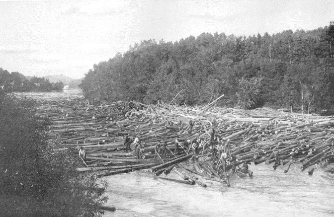
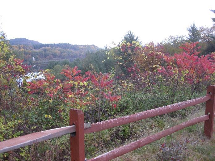
 Before starting your hike, walk to the fence at the west end of the flat, high terrace above the river. From here, you enjoy a splendid view up the mighty Connecticut, the largest river in New England. First-person accounts of the river log drives of the 1890s-1930s mention that word quickly got around when the log drives were approaching the area. Townspeople would flock to viewpoints above the river to watch the grand spectacle. We can just picture families arriving at this very viewpoint with their picnic baskets and parasols, hoping for a glimpse of the “river rats” (daredevil log drivers) hopping from giant log to giant log with their spiked boots.
- Give three cheers for Kendal Riverfront Park! In a fine example of public-private partnership, the Town of Hanover and Kendal found a way to welcome the public at this prime riverfront property. The land (former site of the Chieftain Motel) is owned by Kendal, and the Town manages the details of public access.
- Walk past the gate and down the gravel drive toward the river through a steep ravine. Clearly not designed for two-way traffic, this drive is open only to authorized vehicles – think trailers stacked with rowing shells.
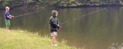
- A trail at L leads to a nice network of private trails on the main Kendal property. Stay R and head for the shore. Arrive at a wide, grassy floodplain area, the lowest terrace. In season, colorful crew boats, stacked on trailers on a higher terrace, await their chance at glory on the river. This area is the scene of many regional crew races on the flat water impounded by Wilder Dam, a few miles downstream.
- Head to the water’s edge; if the large floating dock is in the water, you’ll have an even better view upriver to flat-topped Smarts Mountain in Lyme. Across the river among the pines is Patchen’s Point, a pleasant picnic spot accessed by trail from Route 5 in Norwich.
- After enjoying the river and sending silent thanks to Kendal and the Town of Hanover for opening this area for you, walk back up the short but steep drive and then 4 minutes’ walk down Chieftain Hill along Route 10’s bike lane. At the bottom is Camp Brook’s confluence with the Connecticut River.
- Cross Route 10 (carefully) where the guard rail ends on the opposite side of the road. A sign marks the path into the Rinker-Steele Natural Area and along the N shore of Rinker Pond.
 The pond takes its name from the family who once owned the riverfront parcel you passed on your way from Kendal Park. The Hanover Conservancy purchased the 17.62 acre Rinker Tract in 1973 from Mr. and Mrs. Jack Rinker, holding it until the town’s Conservation Commission could buy it with a grant from the federal Land and Water Conservation Fund.
- The path skirts the water’s edge and, depending on whether Wilder Dam is generating power or storing water, may be wet in places.
- Stop here at the steep hillside at L – you’re at the old quarry, said to be the source of stone for the White Church in Hanover.
- The trail leaves the pond shore and swings steeply up through the hemlocks and pines on a well-benched path. The Conservation Commission’s blue & white blazes mark the route.
- This narrower path threads its way through a wild, dramatic landscape, following the heights of knolls between steep ravines.
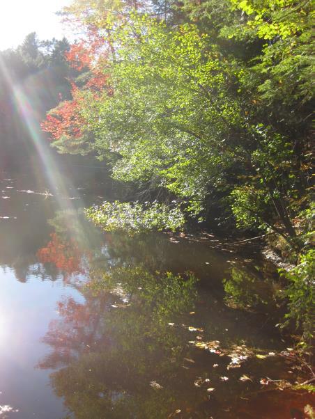
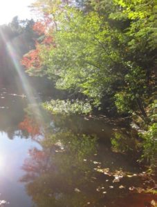
- Five minutes’ walk from Route 10 brings you to a pretty overlook, high over the pond below. Sunlight filtering through the foliage and glinting off the water below makes a stirring sight at odds with the sounds of traffic on the road behind you.
- Tiptoe around the root mass of a large downed hemlock. The small pit left when the tree fell makes you wonder what held it up for so many years.
- Follow the N arm of the pond to its end.
- 8 minutes from Route 10, a green sign directs you R toward Storrs Pond, and the landscape drama intensifies – knobs, knolls, ferny glades. What’s going on here? You are actually hiking on what was once the bottom of glacial Lake Hitchcock. This frigid lake covered the Connecticut River valley from Middletown, CT to Littleton, NH after the river’s waters were trapped by a dam of debris dropped by the glacier as it melted. Thousands of years later, of course, that dam broke, leaving us with the beautiful winding river we see today. While the lake was in place, however, soil washing in from the uplands settled on the lake bottom. In still water, such as that quieted by a glaze of ice, the finest particles of clay sink to the bottom. When the lake drained, Camp Brook flowed down through the newly exposed sediments, slicing deep channels through them on its way to meet the river. These old channels are now the steep ravines that surround you.
- The trail crosses a small wooden bridge and the Rinker Bike Loop comes in at L. Bicycles are permitted only on this part of the Rinker-Steele Natural Area. Continue straight.
- It seems incredible, but part of this land was once grazed by sheep, or at least they were contained here. A fragment of wide-grid sheep fencing remains next to the trail, nailed to a dead yellow birch. Most of this land was just too steep for farming, and some trees here are therefore quite old.
- Cross onto land of the Storrs Pond Recreation Area (not conserved) and, 15 minutes from Route 10, arrive at a wide ski trail. A sign at R confirms this junction. Turn R onto the wide trail and down a gentle slope to the sunny area by the dam at the end of Storrs Pond.
- Storrs Pond is part of what must be Hanover’s hardest working watershed – Camp Brook. This brook begins on lands owned in the 1800s by the Camp family that are now held by the Trescott Company (50% Town of Hanover, 50% Dartmouth College). The Hanover Water Works bought those lands in 1893-1912 to create the public water supply. Camp Brook was dammed in 1893 to form the Fletcher Reservoir (where Grasse and Reservoir Roads meet) and upstream in 1924 to form the Parker Reservoir. After filtering, much of its water ends up on downtown restaurant tables, in college dorms, and domestic faucets. What’s left continues downhill along upper Reservoir Road and into another artificial pond created by a third earthen dam. This is Storrs Pond, and thanks to the Hanover Improvement Society, there’s a lot of fun to be had here!
- Cross the dam and note the pond’s outlet below at R, leading to Rinker Pond. Continue as the ski trail swings up and L among white pines that invaded old farmland about 75 years ago. The route is easy to follow.
- The view into steep, wooded ravines changes constantly as the path turns this way and that. From the first dip after leaving the dam, spot Rinker Pond on the R. Four minutes’ walk from the dam, as you head down to the second dip, note the steep hill at R on the Steele Tract – you’ll soon be up at the top looking down.
- At the bottom of the second dip the trail to the Scout Area comes in at L. Stay straight. An arm of Storrs Pond appears through the trees at L. Head up the next rise.
- 8 minutes’ walk from the dam, the entrance to Ferguson Field comes into view. Look for a brown/yellow sign at R marking the entrance to the Steele Trail.
- Turn R up the hill onto this new yellow-blazed trail, completed in Fall, 2017. The trail follows an old woods road for a short time and swings R on a gradual slope. A double blaze soon indicates a sharp L turn onto a narrower trail. Head up this path and reach the height of land after 2 more minutes.
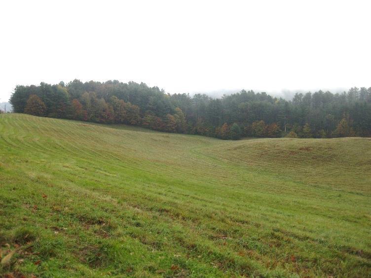
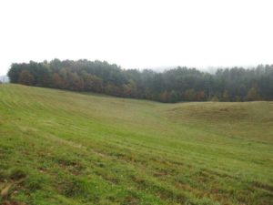 Look for a yellow blaze about 15’ to the R. This is a spur trail to the Steele overlook. Take this path through the gap in a large fallen log and in 2 minutes reach the top of the knoll you passed earlier. The grove of solemn pines and hemlocks confers a special silence upon this place, despite its proximity to Route 10. A chipmunk scolds the traffic for disrupting the peace. Plans for this area include some view clearing and a bench. The Town of Hanover and the Kendal community led a successful drive to purchase the Steele Tract in 2010, with help from the Hanover Conservancy, extinguishing what could have been a house lot with a driveway across Ferguson Field. Today the property is managed by the Conservation Commission and protected, with the Rinker Tract, by a Conservancy conservation easement.
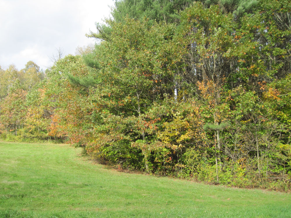
- Retrace your steps to the junction of the trail you took from below, and continue straight on this gentle path. In 2 more minutes it meets Ferguson Field at a “wolf” pine, a large, many-limbed white pine that has overseen many mowings of this field, from hayfield days to ski race times. Ferguson Field, a softened version of the steep hills below, was once part of the Ferguson Farm. The historic white farmhouse, a cape, remains near the Kendal entrance. The field is owned by the Hanover Improvement Society and protected by a conservation easement. The Hanover Conservancy acquired the field from Mrs. Ferguson in 1989, holding it until it could be conveyed to H.I.S.
 A mown path slabs across the meadow to a point opposite the Kendal entrance on Route 10, along with other mown trails that are a pleasure to wander. Today, you can traverse the field or return more directly to your car (6 minutes) by heading R uphill to Route 10. Follow the bike lane on the R side of the road down to the best crossing place, a point opposite the Kendal Park sign.
- Return to your car at Kendal Riverfront Park and resolve to return for your own family picnic by the river!

Learn more about the Rinker-Steele Natural Area and Kendal Riverfront Park.

 Storrs Pond is part of what must be Hanover’s hardest working watershed – Camp Brook. This brook begins on lands owned in the 1800s by the Camp family that are now held by the Trescott Company (50% Town of Hanover, 50% Dartmouth College). The Hanover Water Works bought those lands in 1893-1912 to create the public water supply. Camp Brook was dammed in 1893 to form the Fletcher Reservoir (where Grasse and Reservoir Roads meet) and again in 1924 to form the Parker Reservoir upstream. After filtering, much of its water ends up on downtown restaurant tables, in college dorms, and domestic faucets. What’s left continues downhill along upper Reservoir Road and into another artificial pond created by a third earthen dam. We know this one as Storrs Pond, and thanks to the Hanover Improvement Society, there’s a lot of fun to be had here!