A loop hike close to town that feels far away.
Difficulty: Easy
Distance: 2.6 miles round trip
Elevation gain: 180 feet
Time: 1 hour
Distance: 2.6 miles round trip
Elevation gain: 180 feet
Time: 1 hour
Categories: Hike of the Month, Hudson Farm, September
Tags: Appalachian Trail
Trail Directions and Map – Full Hike
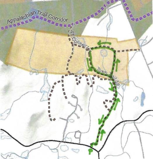 Driving Directions
- From the traffic light at Route 120 and Greensboro Road, take Greensboro Road east for 1.8 miles to its junction with Etna and Great Hollow Roads.
- Park at the roadside pull-off. If you prefer off-road parking, turn in at David Farr Memorial Park and bear R and downhill to a shaded gravel parking area.
- Today’s hike on an historic highway includes a loop through the now-protected Hudson Farm’s fields and forest.
What You Should Know
- This is a fun and easy hike with a few sections of tricky footing among roots or rocks. The route is well-blazed.
- The route follows an early road and then travels a loop on one of Hanover’s newest conservation lands. In 2017, the National Park Service purchased the Hudson Farm (brown-shaded area on map) to permanently protect it as part of the Appalachian Trail corridor.
- Trails are maintained by Hanover Trails Committee volunteers and Berrill Farm neighbors.
- Dogs are welcome but must be under your control; please pick up after your pet.
- Snowmobiles, ATVs, and bicycles are not permitted.
Hiking Directions
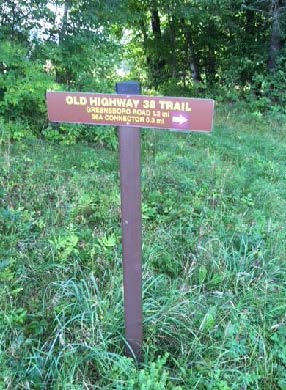
- Begin your hike on Greensboro Road at the blue town sign marking the Old Highway 38 Trail, directly opposite the town’s Farr Memorial Park.
- The old road leads between two contemporary houses and shortly turns R (marked with arrow), immediately diving back into time at a pair of old stone walls – the first of many you will encounter today.
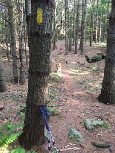 Don’t be dismayed by the steep path that suddenly appears– the rest of the hike is gentle and rolling. Follow the yellow blazes into the woods.
- Town Highway 38 has a murky history. Laid out in 1795, it connected Greensboro and Trescott Roads. It was later discontinued, but its exact route was so hard to trace that when planning began for Berrill Farms in 1979, the town agreed with the developer on a route to be called the “Old Highway 38 Trail.”
- The trail passes through a knobby landscape covered with ferns and a young forest of white pine. The stubs of lower branches encircling each tree are clues that these pines grew up together in an abandoned field, self-pruning those branches as the canopy closed in and blocked out the sun. A few venerable, much older maples survive.
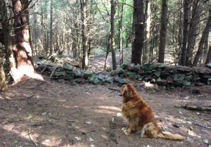
- Eight minutes from the trailhead you cross a fine stone wall. Follow it with your eyes to another at R, running parallel to the trail.
- A few minutes later, take care crossing a wet spot, where “tree cookies” placed as pavers can be slippery. A small wooden bridge takes the trail over a space that is wetter in other seasons.
- Six minutes from the first wall crossing, a trail comes in at L at the top of a small rise. This trail is closed to all but Berrill Farms residents. Continue straight, toward a blaze on a large, triple-trunk white pine. The nature of the forest has shifted, with more deciduous hardwoods, belying a different history.
- You soon encounter another stone wall, this one built with much smaller stones – a clue that it once bordered cultivated land. The builder wished to spare his plow and give his carrot seedlings a chance by stooping to move and stack smaller stones. Had he been grazing sheep here, he wouldn’t have bothered. Take a moment to peel the years off this scene in your imagination, to a time nearly 200 years ago when the only trees were a few young maples left as shade for sheep, when sunlight flooded the ground you’re walking, and the view stretched E to nearby Mill Village, now called Etna. Time, and the end of the sheep craze, brought back the trees.
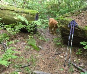 Seven minutes’ walk from the trail junction, you pass through a slot in the fallen bole of a big pine, nearly 3 feet through. That’s big – but trace it back to where it fell – it was once part of a massive ring of three trunks! These softwoods grow more quickly than hardwoods like maples and oaks, so despite its imposing size, it’s likely younger than most of the hardwoods.
- The trail swings up and L and follows a stone wall that retains barbed wire from when cattle, not sheep grazed here. At R, a field appears.
- Bear R at a fork in the trail, up onto a mown path into the E meadow of the former Hudson Farm, to begin a steady climb to a line of trees at the top. Monarchs and other butterflies join you at this time of year, alighting on milkweed, clover, and goldenrod among the grasses, and cicadas and grasshoppers contribute the music.
- Five minutes from the woods trail, you arrive at the tree line, where a second field comes into view beyond. You are walking through one of Hanover’s iconic historical farm landscapes.
- Stop for a moment to enjoy the expansive view. Straight ahead, the open slopes of Lebanon’s Storrs Hill stand out, even more so in winter when covered in snow. At R are the Rix Ledges, some of the most interesting terrain and wildlife habitat in Lebanon.
- Approach the small white pine growing by itself in the field, 20 paces away. From this vantage point you can see Mount Ascutney rising in the distance, to the right of Rix Ledges. You won’t be the first to have “The Sound of Music” pop into your head – nobody’s watching, so twirl around and sing!
 In June, 2017, this was the site of a grand celebration. A partnership between the Trust for Public Land and the Town of Hanover, assisted by the Hanover Conservancy, resulted in purchase of the 175-acre Hudson Farm by the National Park Service to permanently protect it as part of the Appalachian Trail corridor. In addition to major federal funding, many local contributions made this possible. Owned for many years by Dartmouth College, the property had been eyed as a site for everything from a cemetery and golf course to a housing development. Today, the AT Conservancy manages the land. The beautiful meadows will be kept open for their spectacular views and valuable grassland bird habitat.
- Returning to the tree line, cross a low stone wall to the other field and a brown and yellow trail sign where two mown paths meet. From here, you can see a 20th century home built as a country retreat by Archer Hudson, a retired architect. Dartmouth College later purchased the property and carved off the house for resale, keeping the land. While the College referred to it as the “Hudson Farm,” the property ceased to be a farm when Hudson arrived.
 When leaves are off the trees, you can also see the Adams Farm house, a late 18th/early 19th century white cape with a single chimney. This was home to the family that once owned the farmland you are exploring today. Hudson purchased land that included the Adams barn – and then burned it down.
- [NOTE: To return along Etna Road, bear R here and take the mown path down through the meadow to Trescott Road and the Hudson Farm trailhead. Turn R on Trescott Road and R on Etna Road to your car.]
- To continue today’s hike, bear L toward the woods to the lowest point in the rolling field.
- Two sets of boardwalks offer dry footing across drainages. The second, larger one was built in 2018 by Hanover Trails Committee volunteers (thank you!). Protecting such headwater wetlands and streams from heavy foot traffic benefits water quality and trout habitat in Mink Brook.
- Soon you’ll see a stone wall at R, reminder that this was once grazing land. Continue as the trail heads gently downhill, with the slabby stone wall on your R until the wall neatly turns a corner of the old pasture.
- Shortly after, a blue sign at R indicates you are heading toward the Appalachian Trail.
- [NOTE: For a much longer adventure, continue straight here, turn L (southbound) on the AT to the Conservancy’s Greensboro Ridge Natural Area, L at Oli’s Trail, L at the Greensboro Highlands Trail, L at the Silent Brook Trail, and then L onto Greensboro Road and walk 1.6 miles back to your car.]
- To continue today’s hike, turn L at the blue sign and follow the yellow blazes past impressive white pines. The trail slabs along the contour. It is discouraging to note the invasion of non-native barberry (a prickly shrub) and glossy buckthorn (find its black berries underfoot among the pine needles). Consider volunteering for organized work parties to remove these pests from conservation land. Or, volunteer to remove them from your own property, to help keep them from spreading. Learn more about these invasives from the Hanover Conservation Commission’s Biodiversity Committee.
- Continue down the hill to a small drainage that may be nearly dry at this season. The trail crosses it in two places and bears R. About 15 minutes from the top of the fields, you return to the path you took into the first meadow. Continue on the woods path and stay L to avoid a R fork leading over a stone wall. It’s another 15 minutes back to your car from here.
- The trail soon swings R and down toward Greensboro Road. Listen for the two-part whistle of a broad-wing hawk and keep an eye out for mushrooms. These fungi decorate the forest floor at this time of year, in colors ranging from purest white to bloody red.
- The sound of traffic is a clue that you are nearing Greensboro Road. A pair of granite boulders serve as your gateway back from Hanover’s past to its present.
8/30/2018


