A walk to the bottom of Lake Hitchcock.
Distance: 2 miles round trip
Elevation gain: 140 feet
Time: 1.25 hours
Categories: Hike of the Month, November, Rinker-Steele
Tags: Hanover Improvement Society, maidenhair fern
Trail Description and Hike – Full PDF
 Driving Directions
- From Downtown Hanover, drive N on N. Park Street and turn right onto Route 10N. Continue past the golf course, through the first rotary, and past the Richmond School and Dartmouth Printing. Turn right for 71 Lyme Road at sign for the Hanover Conservancy.
- Park in the office parking lot. If it’s a weekday, stop in at the Conservancy’s offices on the lower level to say hello!
What You Should Know
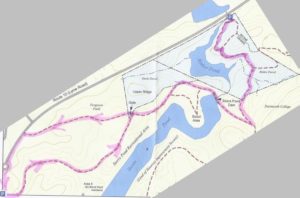
- Today’s loop hike takes you through the Storrs Pond Recreation Area to the Rinker-Steele Natural Area, through Ferguson Field, and back along a short section of Route 10.
- You’ll be walking on lands owned by the Town of Hanover and the Hanover Improvement Society. Conservation easements protect some but not all of this land.
- Trails have many short but steep up-and-down grades – you’ll get a good workout! Clay soils can make for slippery footing on a wet day.
- In winter, some of these trails are groomed for skiing – and should not be used by hikers.
- We suggest bringing a hand lens – you’ll find out why.
- Dogs are welcome but must be under your control; please pick up after your pet.
Hiking Directions
- Begin your hike at the south end of the parking lot, at a gate across the lane that heads down to Storrs Pond. Take this lane and in 100 yards, turn L and up a slight hill. You’ll begin an up and down saunter on a wide ski trail, among white pines that invaded old farmland about 60 years ago. The route is easy to follow.
- At this time of year you may notice that most understory trees have lost their leaves but one kind still seems healthy and green –glossy buckthorn, an invasive tree that gets its edge from photosynthesizing far into the fall after native trees have given up for the year.
- The view into steep, wooded ravines changes constantly as the path turns this way and that. We’ll explain the reason for this dramatic landscape farther into the hike.
- Six minutes from your car, you reach the bottom of the hill. At R is the covered pavilion at Area 5 of the Storrs Pond Recreation Area. Turn L and head straight uphill past the sign for the Storrs Pond Trail and Scout Area. Soon you’ll have a view of an arm of Storrs Pond on the R.
 Storrs Pond is part of what must be Hanover’s hardest working watershed – Camp Brook. This brook begins on lands owned in the 1800s by the Camp family that are now held by the Trescott Company (50% Town of Hanover, 50% Dartmouth College). The Hanover Water Works bought those lands in 1893-1912 to create the public water supply. Camp Brook was dammed in 1893 to form the Fletcher Reservoir (where Grasse and Reservoir Roads meet) and again in 1924 to form the Parker Reservoir upstream. After filtering, much of its water ends up on downtown restaurant tables, in college dorms, and domestic faucets. What’s left continues downhill along upper Reservoir Road and into another artificial pond created by a third earthen dam. We know this one as Storrs Pond, and thanks to the Hanover Improvement Society, there’s a lot of fun to be had here!
- Eleven minutes from your car, you’ll reach a junction. At L is the gate to Ferguson Field; you’ll return to this spot later. Turn R along the southern boundary of the former Steele property.
- Look for a pockmarked old pine on the R that is providing quite the chickadee condominium. You notice greater tree diversity here – instead of young pine and buckthorn, you’ve moved into a proper hemlock-northern hardwoods forest with maples, oaks, and birches, an older forest that’s seen less interference.
- At a fork, take the main trail up to the L. The trail then curves to the R, affording a sudden view straight down into Rinker Pond. Yet another dam, you ask? Wait and see.
- You’ll soon come to a hemlock cut into sections after it fell across the trail. While it may not strike you as a particularly large tree, pull out that hand lens to look at its growth rings. See how tightly packed they are – indicating hemlock’s naturally slow growth in the shade of its companions. We counted over 140 rings on one section –the tree was likely already growing during the Civil War.
- Two minutes’ walk later, you cross the dam that creates Storrs Pond. In October, 2016, after a droughty summer and fall, the water was down four feet from the top of the outlet pipe.
- Continue up the hill and look for a trail on the L just past the overhead ladder on the R. Here, the wider trail winds up to the R toward Oak Hill and you turn L onto the narrower path to the 24-acre Rinker-Steele Natural Area. You’re about 25 minutes from your car.
- The Hanover Conservancy purchased the 17.62 acre Rinker Tract in 1973 from Mr. and Mrs. Jack Rinker, who lived across Route 10 just north of the former Chieftain Inn. The Conservancy held this parcel until the town’s Conservation Commission could buy it with a grant from the Land and Water Conservation Fund.
- This narrower path threads its way through a wild, dramatic landscape, following the heights of knolls between steep ravines. The Conservation Commission’s blue/white blazes mark the route.
- It seems incredible, but part of this land was once grazed by sheep, or at least they were contained here. A fragment of wide-grid sheep fencing remains next to the trail, nailed to a dead yellow birch and flagged with orange. Most of this land was just too steep for farming, and some trees here are therefore quite old.
- Half an hour from your car, cross a small wooden bridge spanning the drainage from a lush little valley that is moist even in the driest times of year. A brown and yellow sign indicates the junction of the Rinker Bike Loop. Turn L on a trail closed to bikes.
- The trail approaches Rinker Pond and soon hugs the slope directly above the water. It’s a pretty dramatic landscape! What’s going on here? You are actually hiking at what was once the bottom of glacial Lake Hitchcock. This frigid lake covered the Connecticut River valley from Middletown, CT to Littleton, NH after the river’s waters trapped by a dam of debris dropped by the glacier as it melted. Thousands of years later, of course, that dam broke, leaving us with the beautiful winding river we see today. While the lake was in place, however, soil washing in from the uplands settled on the lake bottom. In still water, such as that quieted by a glaze of ice, the finest particles of clay sink to the bottom. When the lake drained, Camp Brook flowed down through the newly exposed sediments, slicing deep channels through them on its way to meet the river. These old channels are now the steep ravines that surround you.
- You arrive at a large uprooted hemlock. The blazes on its prostrate trunk indicate it served as a trail marker until quite recently. Walk around its root ball to see the pale, lake-bottom clay revealed among its roots and in the pit where it once grew.
- Continue on the path toward the Brook Trail.
-

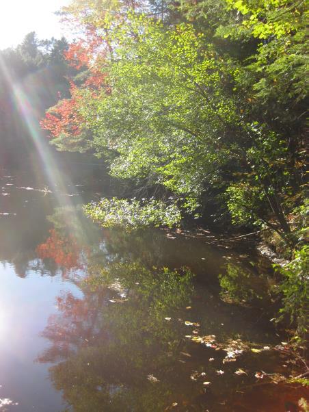
Rinker Pond You hear traffic on Route 10 before you see it –the sound seems out of place next to this still reflecting pond surrounded by the soft needles of old hemlocks. Soon, the path reaches the water’s edge and Route 10 appears. Just beyond, through a culvert too deeply submerged to be seen, is Camp Brook’s confluence with the Connecticut. So – is Rinker Pond just another one in the brook’s chain? No – it’s actually a blend of brook and river water backed up behind Wilder Dam, miles downstream on the Connecticut!
- The path ahead may be flooded, depending on whether Wilder Dam is generating power or storing water – an unnatural sight in a time of drought and another sign that the water table is affected by operations at Wilder Dam.
- Stop here and look on the steep hillside ahead and to the R – you’re at the old quarry, said to be the source of stone for the White Church in Hanover.
- If the path is dry, continue a short ways to the road, where there is parking for two cars (legal, despite the “No Parking” signs nearby). In any case, you’ll turn around and go back up the trail toward Storrs Pond. Take a moment to look for the bright red berries of wintergreen at your feet.
- Return around the fallen hemlock and across the small bridge. Keep an eye out for maidenhair fern at R and then a “giraffe” tree you might not have noticed on the way down. Here, a yellow birch took root on an old stump that later rotted away, leaving the birch’s roots as props holding it off the ground.
- 50 minutes after leaving your car, return to the wide ski trail and turn R. Note the lush growth of evergreen Christmas fern on the R. Continue across the dam.
- Just as the trail bears L and downhill, look straight ahead. This is the six-acre Steele Tract, added to the Rinker Tract in 2010 with contributions from many generous donors, including $25,000 from the Hanover Conservancy. Nine years in the making, this project gathered wide community support and eliminated the possibility of a driveway across Ferguson Field. The Conservancy now holds a conservation easement on the combined property.
- At a fork, instead of continuing back the way you came, bear R through the gate to the foot of Ferguson Field.
- One of the glories of the northern gateway to Hanover, Ferguson Field is owned by the Hanover Improvement Society and is protected by a conservation easement. The Hanover Conservancy acquired the field from Mrs. Ferguson in 1989, holding it until it could be conveyed to H.I.S.
- Follow the mown path up through the field to the far corner toward the historic Ferguson farmhouse, visible on the far side of Route 10.
- The path passes through former farmland, a much-softened version of the steep hillocks below.
- From the top of the field, look N behind you to the new Steele trail, built across the field to a wooded knoll in early November, 2016.
- Turn L to walk the remaining 4-5 minutes around the small rotary and back to your car at 71 Lyme Road.
Learn more about the Rinker-Steele Natural Area


