Hanover Conservancy

Facebook logo   Instagram   YouTube          
Donate button
  • Home
  • About Us
    • Celebrating 60 Years
    • What We Do
      • Advocacy
      • Conservation
      • Education
      • Stewardship
    • Board & Staff
    • Membership Benefits
    • Contact Us
  • Get Outdoors
    • Hanover Lands
      • Balch Hill Natural Area
      • Mink Brook Nature Preserve
      • Other Properties
    • Hanover Hikes
    • Hanover Trails Challenge
    • Upper Valley Hikes
    • Exploring Nature at Home
    • Hunting
  • Events
    • Calendar
    • Spring Wildflower Scavenger Hunt
    • Private Events
  • Get Involved
    • Donate
    • Volunteer
    • Adopt a Trail
    • Corporate Conservators
    • Planned Giving
  • Education
    • School Programs
      • KAST
      • Connecticut River Studies
      • Hanover High School Scholarship
    • Request a Field Trip or Speaker
    • Research on Our Lands
    • Hanover History
    • Resources
  • News
    • Remembering Bob Norman
    • Reports & e-News
  • Conserve Your Land

Explore the New Black Bear Loop

January 14, 2021

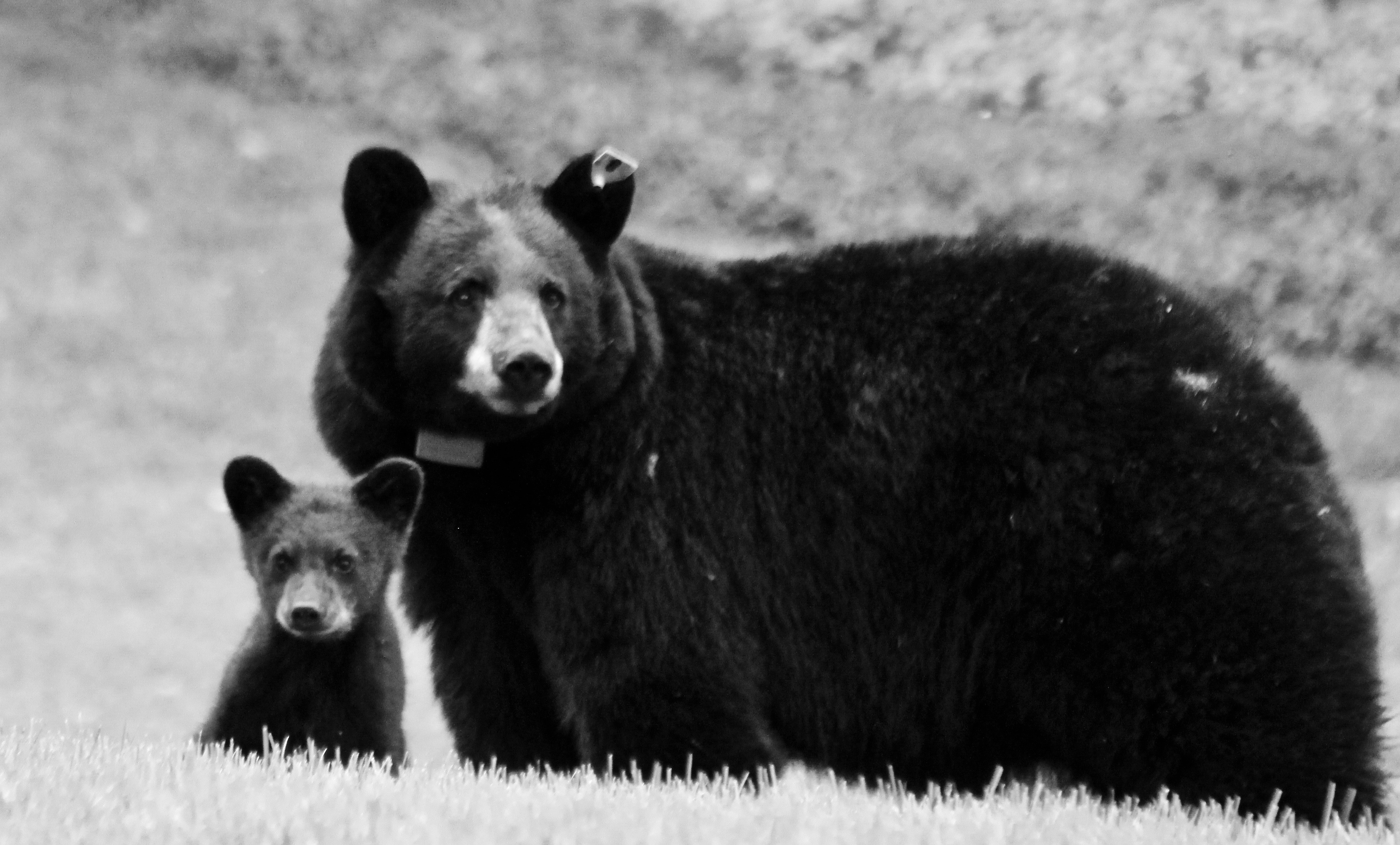
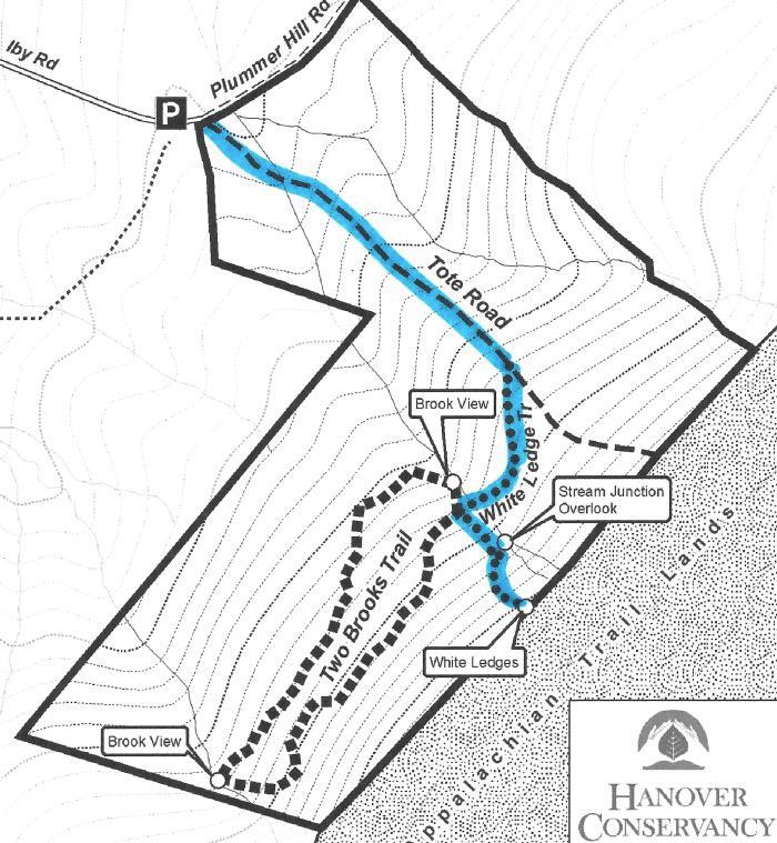
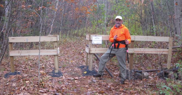
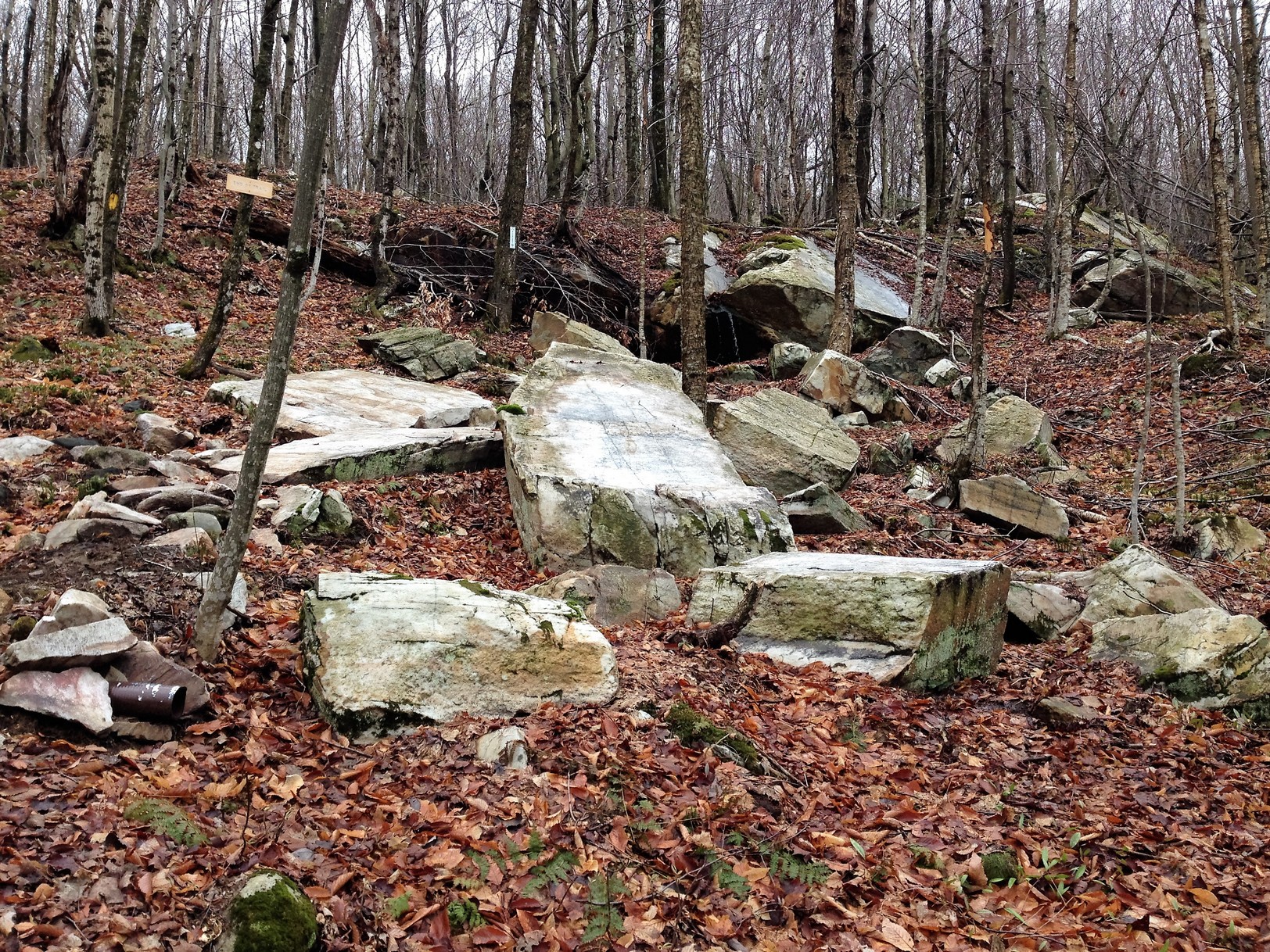
Hike on our newest trail at the Britton Forest on Moose Mountain. Built in 2020 by the Upper Valley Trails Alliance’s High School Trail Corps and volunteers from Hypertherm, the ~ 1 mile trail explores a gentle to moderately challenging route through the forest. We’ll look for wildlife signs in the winter woods. Snowshoes or micro-spikes are recommended, depending on conditions; gear is available to borrow.

Level: Easy (one brief moderate slope)

Leader: Adair Mulligan

Group size is limited to 9 participants + 1 leader; pre-registration here is required. Note that we maintain a small waitlist for pre-scheduled events (not for our pop-up trips). If your plans change, please let us know! You will be contacted before each trip to confirm your spot, so that we may offer room to someone else if available.

Tagged With: bear, Britton Forest, Moose Mountain, snowshoe

Bear Update

June 29, 2018

We’re sad to report that the family of black bears at the Mink Brook NP have been trapped and relocated after more than a year of concentrated efforts by town and state officials to educate our human residents. With another large bear family only a few miles away, our efforts to become better neighbors to these beautiful, typically shy animals will certainly continue! Read more here…

Version 2

Filed Under: Bears, Conservation, Mink Brook, Partnerships, Wildlife Tagged With: bear, black bear, cubs, Fish & Game, Mink, relocated

The White Ledges of the Mayor-Niles Forest

July 1, 2016

Full loop in PDF format


Mayor-Niles trail map
Trail map

Driving Directions

  • From the Hanover Center green, head north on Hanover Center Road.
  • Shortly before the intersection of Rennie Road, turn east on Ferson Road.
  • Turn left at the T onto Three Mile Road.
  • Turn right at the T onto Ibey (Iby) Road.
  • Proceed up the hill 0.1 mile to the small parking area at the road’s end.

What You Should Know

  • Foot travel only. Dogs are welcome but must be under close control; please pick up after your pet.
  • Be aware that this is prime porcupine and bear habitat!
  • The trails are well-signed and marked. The wide Tote Road is not blazed but easy to follow. The White Ledge Trail is blazed in red.
  • The 92-acre Mayor-Niles Forest was the generous gift of Michael and Elizabeth Mayor and John Niles, who had owned the land for some 20 years. The Conservancy accepted the land in 2013 to protect valuable high elevation wildlife habitat, the headwaters of Hewes Brook, flood security for downstream neighbors, and a scenic backdrop, all the while adding to the block of contiguous protected habitat on Moose Mountain surrounding the Appalachian Trail.
  • The trails were created in 2016 by carefully laying out routes to avoid creating erosion on sensitive soils and disrupting rare plant habitats.

Hiking Directions

  • Park your car on the left, opposite a gray cape house. This house stands on the site of the former Smith farmhouse, which was standing here by 1799. By 1892, it was owned by H. L. Barnes. The lower parts of this land were once open sheep pasture. Note the stone wall separating the house and drive from the protected Forest.
  • Ibey Road becomes Plummer Hill Road, a Class VI road, just beyond the parking area and house. The road dead-ends at Plummer Hill, but the Harris Trail, which follows it, continues to Goose Pond Road in Lyme.
  • Start up Plummer Hill Road; in 20 yards turn right at the Conservancy sign posted on a large white pine.
  • Pass through a simple but elegantly designed gate – your first clue that someone really loves and cares for this property.
  • The trail initially passes through an area that was open until fairly recently. It soon moves into the woods after crossing a year-round stream on a narrow foot bridge built by the same volunteer.
  • Standing on the little bridge, you can see woody debris in the channel that captures sediment and keeps waters clear. The Forest is located in the Hewes Brook watershed; protecting this land keeps the waters of this brook shaded and therefore cool, clean, and comfortable for wild brook trout. Keeping the tiny headwater streams well forested with a spongy forest floor also helps soak up heavy rains and release water slowly, contributing to flood security in downstream neighborhoods.
  • Begin a steady climb up the old tote road. This road was used years ago by International Paper Company to haul timber off Moose Mountain. Occasional water bars have been installed to divert runoff to cope with the slope, preventing gullies in this steep, direct path.
  • As you move upslope, you’ll notice many small red spruce trees coming up along the path, marking the shift to cooler growing conditions. This higher elevation habitat will become an increasingly important refuge as the effects of climate change become more pronounced. Feel the branches to distinguish prickly red spruce from the soft branchlets of hemlock.
  • On the forest floor near the path, you may see ground cedar, ground pine, wild oats, and starflower.
  • After ten minutes’ steady climb, you’ll arrive at a well-marked turn onto the White Ledge Trail. If you stayed on the Tote Road, you’d come to the yellow-blazed boundary with the federal Appalachian Trail corridor land. While we’d love to create a trail connection with the AT here, such connections are carefully limited.
  • Turn right onto the red-blazed White Ledge Trail. Why not blaze it white, you ask? Only the AT is blazed white in Hanover!
  • The trail follows the mountainside contour as it heads south, a pleasant (but temporary!) relief from the steeper Tote Road. It passes through multi-aged northern hardwood forest that was last harvested about 20-25 years ago. Look for three kinds of birch (white, yellow, and gray), oak, beech, and four species of maple (sugar, red, goosefoot or striped, and mountain).
  • About 5 minutes from the Tote Road, you’ll come to another even more delightfully crafted brook crossing, this one with a white birch handrail. While the steep brook channel is dry in summer, the amount of woody and leafy debris in its channel testifies to the power of heavy rain and gravity.
  • A few yards beyond the little bridge, you arrive at a four-way trail intersection. The Two Brooks Trail leads straight ahead and loops around, returning to the right. To best appreciate it, save this trail for a day after rain or in late spring.
  • Joe Danna, Jr. by trail gateTurn left to continue on the White Ledge Trail, again heading uphill. White ash, black cherry, and other hardwoods join the birches and some impressive maples. The trail is steep in places but steps and careful trail benching create a safe pathway. By now, you’re curious about the person who lavished such attention on this tricky part of the path! We are fortunate to have Joe Danna, Jr. (right) to thank for all this work. A tireless Hanover Conservancy volunteer and nearby resident, Joe laid out, cleared, stabilized, and blazed these trails with the help of our Stewardship Committee and John Taylor of the Upper Valley Trails Alliance.
  • The trail continues to climb, sometimes steeply. Take care to turn right at a stake with red paint. As you wend your way to your goal, the White Ledges will come into view, their cool white forms almost glowing in the dark forest.
  • About 30 minutes’ hike from your car, a routed sign just past the ledges indicates you’ve reached the trail’s end. Just beyond you’ll see a bold yellow boundary blaze and vertical white sign reading, “U.S. Boundary” marking the protected lands surrounding the Appalachian Trail. YOU (and a couple hundred million other Americans) own that land. Moose, bear, and bobcat thank you for it.
  • White ledges at Mayor-NilesLinger at the White Ledges for a bit to marvel at the color and shape of this quartzite outcropping. Did you bring a picnic? One of those strikes us as a good picnic rock; our favorite is the smoothly angled one that looks like the prow of an ice cutting ship. Dartmouth Earth Science professor and former Hanover Conservancy Board member Carl Renshaw explains,

“Moose Mountain is composed of a core of Clough quartzite that is highly resistant to weathering. Outcrops of this quartzite, often called the ‘white ledges,’ are visible on the Mayor-Niles Forest, especially in one area close to the AT corridor boundary, where one may observe large, angular slabs of quartzite colored with small amounts of iron and lines composed of later quartzite intrusions.

“At one time, this place would have resembled a white, sandy beach composed of the material eroded from the high mountains that once ringed the area. When the continent was in a more southern position on the globe, the climate would have been warmer. The shape of the inland sea would have resulted in good-sized waves – creating conditions for a great surfing beach on the side of Moose Mountain. Heat and pressure later solidified these solid sand grains into the quartzite we observe today.

“The collisions of England, the Bronson island chain, and later Africa into North America were a major event that created the Appalachian Mountains some 400 million years ago – once the largest mountains in the world, at least two miles high. The Mayor-Niles Forest and the rest of the region are overlain by the Littleton Formation. On lower elevations on the property, this rock is exposed and contains small red crystals of garnet, indicating high temperature and pressure in the formation of this metamorphosed rock, and confirming that the mountains that existed here were relatively high. Fool’s gold, lead, and arsenic are other components of this dark gray rock.”

  • Take a moment to look for wildflowers here, too. Trillium, starflower, and violets have past blooming but their foliage remains. Among the clubmosses, you may see ground cedar, shining clubmoss, and ground pine. Some young hobblebush nearby will glow with purple foliage in fall.
  • When you’re ready to leave, follow the red blazes back to the four-way trail intersection and turn right toward the Tote Road, crossing Joe’s birch bridge.
  • Stop at the Tote Road junction to search the bark of nearby trees for clues to two different kinds of visitors. A few larger maples on the far side of the road show scarring near their bases received when loads of felled trees, hauled down the tote road, bumped into them. On your left, look high on the uphill side of some nearby beech trees to see claw marks from bears climbing the beeches in search of tasty, nutritious beechnuts.
  • Continue down the Tote Road, noting the diversity of ferns you’ve seen growing at the Mayor-Niles Forest: ostrich fern, woodfern, sensitive fern, the leathery evergreen Christmas fern, and, near Joe’s lower bridge, a nice gathering of New York fern.
  • Reach Plummer Hill Road and turn left toward your car.

The Hanover Conservancy owns and manages the Mayor-Niles Forest. We warmly welcome donations to our Land Stewardship Fund to help maintain the property. Contact info@hanoverconservancy.org. Learn more about the Forest.

Filed Under: Hike of the Month, July, Mayor-Niles Forest Tagged With: bear, hobblebush, quartzite, starflower, trillium

71 Lyme Road
Hanover, NH 03755
(603) 643-3433

info@hanoverconservancy.org

Facebook logo   Instagram   YouTube

Get Involved

Become a Member

Volunteer

Business Sponsors

Conserve Your Land

Employment

Our Mission

Advocacy

Conservation

Education

Stewardship

Explore Hanover

Hanover Hikes

Upcoming Events

Upper Valley Hikes

Trails Challenge

Copyright © 2025 Hanover Conservancy | Design by Chase Brook Software