Looking to explore the new trails at Trescott Water Supply Lands this summer? Check out their new trail guide & map to plan your next hike!
New Trail Map for Trescott Water Supply Lands
The Trescott Water Supply Lands have been busy this summer adding new trails to the property with the help of Upper Valley Trails Alliance and Hypertherm Volunteers.
Check out the updated trail map here! 2021 Trescott Trail Map
Hike at the Trescott Water Supply Lands
Explore a great new loop at the Trescott Water supply Lands. We’ll head east past cellar holes on historic Paine Road and return on the new Perimeter trail along the southern boundary, watching for wildlife signs in the winter woods.
Meet: Trescott Rd. trailhead
Leader: Tom Jack
Level: Easy
Snowshoes or micro-spikes available to borrow at site!
Registration for this hike is encouraged: register here!
All Events are free and open to the public. No dogs, please!
Oak Hill: Up, Down, Roundabout
HANOVER HIKE OF THE MONTH – 11-2020 Oak Hill Up, Down, Roundabout{full directions; PDF}
Driving directions:
- From Downtown Hanover, take Route 10/Lyme Road N past golf course, fire station, schools, and CRREL.
- Turn R at 71 Lyme Road (opposite Rivercrest) to the Hanover Conservancy’s offices and Lyme Road Dental. Park in the area closest to Sheridan Printing.
- Please stop in to say hello if our office is open! We are located in the lower level of the building.
- Today’s hike begins and ends on Storrs Pond Recreation Area trails and explores a loop on the N and W sides of Oak Hill.
What you should know:
- This is a mostly easy hike, especially where it follows wide ski trails, but with some steep sections and occasionally tricky footing among roots or rocks. The route is partially signed.
- Expect to share the trail with mountain bikers.
- Dogs are welcome but must be under your control; please pick up after your pet. Dogs are not permitted within 25 of groomed ski trails during ski season.
- Deer hunting is permitted; dress appropriately.
- During ski season, hikers and snowshoers must stay off the groomed ski tracks.
BRIEF HIKING DIRECTIONS
- From the Lyme Road Dental/Hanover Conservancy parking area, walk around the gate on the lane that runs downhill between this building and Sheridan Printing.
- Turn L at the first turn onto wide ski trail and follow this down to Area 5 at Storrs Pond Recreation Area.
- Turn L and choose the path at R up hill. Turn R onto ski trail at T near base of Ferguson Field.
- Follow ski trail up and down across the Storrs Pond Dam.
- Bear R at junction for Rinker-Steele trail; bear L at 3-way ski trail intersection
- Turn sharply L onto the Game Trail. Stay R at each junction with Frankenstein’s Folly Trail.
- Turn L onto Hunter’s Track and R onto the Fall Line Trail.
- Turn R onto the Crystal Ridge Trail.
- Turn R onto the Screaming Downhill Trail.
- Turn sharp R back onto ski trail, pass the entrance to the Game Trail, and return the way you came.
FULL DIRECTIONS
- Begin your hike by locating the gate at the top of the lane that runs between the Lyme Road Dental/Hanover Conservancy offices and Sheridan Printing. Walk around the gate and head down the hill.
- 2 minutes later, turn L onto a wide ski trail just after the lane briefly flattens. Head up this trail; just past the top of the rise, you’ll see the Conservancy’s office windows at L. Truth be told, we love working here all year round but especially during ski season, when shouts and quavering voices catch our attention as beginner skiers get up their nerve to plunge down this trail.
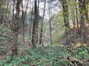 The wide ski trail winds down through a steep-sided valley, one of many such odd landforms characteristic of the old lakebed of glacial Lake Hitchcock. At times in such places, one feels a bit like Alice having dropped into a very corrugated alternative universe.
- 8 minutes from your car, you arrive at a junction. At R is Area 5, a flat field with a large pavilion. This is part of the Storrs Pond Recreation Area, owned and managed by the Hanover Improvement Society.
- You bear L on the narrower path, cross the 5K loop (which leads to the open field above at L) and take the steeper footpath straight ahead, marked
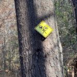 with a yellow snowshoe sign. This path is as much of a roller coaster as the rest, and traces the east edge of Ferguson Field.
 - Turn R at a T near a gate at the far end of the field. In a few minutes, Storrs Pond appears through the trees at R. At L at the crest of the next hill, the Steele Trail is marked with a sign and yellow blaze. That’s a great route for another day.
- Continue on the ski trail up and around toward the Storrs Pond Dam, 20 minutes from your car. Rinker Pond appears below at L. Camp Brook, which begins high on the far side of the Trescott Water Supply Lands, flows downhill to fill Storrs Pond. A pipe buried in the dam delivers water to Rinker Pond below, which is partly backed up by the waters of the Connecticut River behind Wilder Dam far downstream. The water falls 3.5 miles and over 700’ from its source down to the river.
- As you start up the hill on the far side of the dam, note the path at L to the Rinker-Steele Natural Area. This 26-acre property, owned by the Town of Hanover, is protected by a Hanover Conservancy conservation easement and offers some exciting trails that give a true flavor of the dramatic local topography.
- Continue on the ski trail, bearing R and up to a flattened area, the remains of an old lakebed terrace formed as glacial Lake Hitchcock drained in stages. At an intersection, stay L on the higher trail, choosing the option marked 5K. Hemlocks and yellow birch populate this cool forest. In preparation for hosting the NCAA Championships in 2003, Dartmouth College made major ski trail improvements, including in this area.
- 5 minutes’ hike from the Rinker-Steele Trail junction, as you reach the top of a rise and before reaching a yellow snowshoe trail sign, take a hard L off the ski trail onto the narrower Game Trail. This is marked with a sign up ahead on a tree. We’re now headed up into the 254-acre Oak Hill area, owned by Dartmouth College for many years. “Game Trail” is possibly the tamest trail name you’ll encounter; we’d love to know the stories behind the others. Dartmouth’s website freely characterizes this set of trails as a maze – so we’re grateful to Tom Collier, son of former Hanover Conservancy President Nancy Collier, for his efforts to create the map we’re sharing with you here.
- The Game Trail trends moderately up and then slabs along the contour, with the ski trail you just walked visible at L below. In 5 minutes a narrow unmarked trail joins at L; if you need to change your plans, you can take this down to the ski trail and the Storrs Pond dam. Otherwise, continue straight.
- 3 minutes later, bear R as Frankenstein’s Folly (there’s a story there, for sure) forks off at L. That trail forms a loop that rejoins this trail in another 6 minutes. At this next junction, stay R on the upper path. You may hear the sounds of traffic on Route 10 below, but you’re headed up and away from all that.
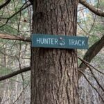
- Shortly, the Up Through the Woods Trail comes in at R; you turn L onto the Hunter’s Track, noting the sign ahead at R.
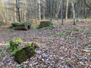 3 minutes later, the Hunter’s Track turns L; you stay straight on the Fall Line. The forest seems different here – old openings sprinkled with large, mossy stumps are signs of logging years back. The Fall Line passes through strange clumps of small gray-stemmed trees – reach out to touch their stems, which resemble a sinewy arm. Indeed, these are musclewood trees! They are also known as blue beech and American hornbeam – small, slow-growing native trees found in the understory of eastern woodlands. A tonic made from this plant was thought to relieve tiredness and its leaves were used to stop bleeding and heal wounds. This useful, very hard-wooded tree was also cultivated as a source of strong poles by coppicing – cutting the tree to promote the growth of sprouts from the roots. Farther on, a tree perforated by a pileated woodpecker indicates that humans are not the only ones at work in the woods.
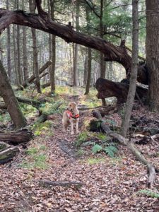 The Crystal Ridge Trail comes in from the L (sign ahead) and heads SSW under a fallen snag. Stop here and look closely at the trees at R; barbed wire is embedded deeply in a very old ash tree, a sign that this was once open pasture. A few paces up the trail the massive remains of an old maple appear at R. Why such huge trees amid all the smaller ones? They likely marked property boundaries, where neither landowner dared cut. The 1892 map of Hanover indicates that the nearest farmsteads in this area were those of Henry Ryder on the E side of Lyme Road near the Fullington Farm and Charles W. Stone, whose home was close to where the Fletcher Reservoir is today. Perhaps the barbed wire marks the boundary between their properties. In 1886, the Grafton County Gazetteer reported that Ryder had 26 dairy cows and leased 660 acres of sugar orchard from Adna Balch, a local leader and legislator who also owned nearby Balch Hill. No cows are to be seen here today, and it looks like many of the sugar maples fell to the axe. Except this one!
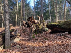 Soon you notice that a wide ski trail is running nearby at L. Don’t be tempted! You’d miss out on some nifty sights. A few minutes later the trail actually passes through the remains of another enormous boundary tree, this one at least 5 feet through at its base.
- Stay on the Crystal Ridge Trail as the Up Through the Woods Trail comes in at R.
- 5 minutes past that junction, arrive at a four-way intersection and stop. Straight ahead is a pine snag, and at R is a jumble of 2 cut mossy logs and a tipped stump. Look closely to the R to spot a blue boundary blaze and 19th century sheep fencing caught in an old hemlock. Before Ryder’s cows pastured here, it was sheep.
- Now turn R at this intersection and down the hill onto an unsigned trail. Blue blazes appear on the hemlocks at R with fragments of sheep fencing and barbed wire. While not marked, know that the name of this trail is Screaming Downhill –prompting you to keep a sharp eye over your shoulder for approaching mountain bikes.
- This part of the forest is distinctly different, composed of tall, straight hemlocks interspersed with white pines. They may look the same size, but the slower-growing hemlocks are likely much older.
- 5 minutes from the intersection, the trail forks at a dip; you bear R among the hemlocks. The downhill end of that same trail rejoins the Screaming Downhill trail 7 minutes later (hiking speed, not biking speed!). Continue straight as the trail moves steadily downhill.
- 6 minutes from the last junction, arrive at the bottom of Screaming Downhill and its junction with a wide ski trail. A sign intended for skiers reads “one way” with the arrow pointing L; you turn R, soon passing the entrance to the Game Trail and closing your loop.
- Stay straight on the wide ski trail, passing the “do not enter” sign for skiers, and in 5 minutes arrive at the junction for the Rinker-Steele trail system.
- From here, you’ll continue to retrace your steps across the Storrs Pond Dam and up and around to the bottom of Ferguson Field. Let’s take a breather from the woods and instead of turning L before the gate, walk around it out to the base of the open field.
- Ferguson Field is owned by the Hanover Improvement Society, and is permanently protected. It is a strange-looking meadow until you recall that the farm family that once owned it must have labored hard to create a hayfield out of the kind of corrugated terrain you’ve been walking through. The early farmhouse that was the Ferguson Farm’s home base still stands across the road – the white cape now owned by Kendal.
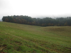 You have one more choice to make – you can take the path across the bottom of the field, re-enter the woods, and turn R onto the ski trail that will bring you up through the woods, past the Conservancy office, and to the lane leading up to your car, OR you can stay in the sunshine and head up the lovely field to the sidewalk along Route 10. Skirt the rotary carefully and use the sidewalk to return to your car.
- 11/17/2020
Biking the New Trescott Trails
Hop on your mountain bike for a guided tour of Trescott’s newest trails, built for hiking, biking and more! Enjoy great fall views and take home a new trail map. Led by Tom Jack.
Level: Moderate.
Pre-registration required HERE; meeting location details will be sent to registrants. Group size limited to 15. Please bring a mask that covers your nose and mouth.


